(The Hungarian version of this blog post is available at the following link, while the Romanian translation can be accessed here.)
100 years ago, on the 1st of December in 1918, a National Assembly was held by and for the Romanians of Transylvania and Hungary in Gyulafehérvár/Alba Iulia. A resolution was declared at the National Assembly in Gyulafehérvár/Alba Iulia on the unification of Romanians from the counties of Transylvania and Eastern Hungary within the Romanian Kingdom.
Romanian territorial claims were -for the most part- supported by ethnic maps, similar to other regionally based powers who forwarded their own land-based claims. On account of the centenary of the peace negotiations after the First World War, this topic became especially prominent within the region. For example, an exhibition of maps was opened in Bucharest in October of 2018 („România Mare reflectată în reprezentări cartografice”) [Greater Romania reflected in cartographic representations] (Biblioteca Academiei Române) [Romanian Academy Library]. In November of 2018, a similar exhibition of maps entitled, "Războiul hărților" [War of the maps] (Muzeul Naţional al Hărţilor şi Cărţii Vechi) [National Museum of Maps and Old Books] also came to fruition. In Hungary, the Map Collection of the National Széchényi Library (Országos Széchenyi Könyvtár, Térképtár) in Budapest holds an ongoing exhibition on ethnic maps which focuses on broader geographic regions (Az I. világháború térképeken: Határviták) [The First World War on maps: border conflicts].
The following, displays a collection of contemporary Romanian ethnic maps. This conglomerate consists of a brief, but well illustrated bibliographical list. It does not offer political or professional analyses, at this time.
In practice, the union, according to Romanian terminology refers to the following regions: Transylvania (Ardeal/Transilvania, Erdély), Crisana (Crișana, Körösvidék), Banat (Banat, Bánság/Bánát), and Maramures (Maramureș/Marmaţia, Máramaros). The final state borders were only designated after the signification of the Treaty of Trianon on the 4th of June in 1920. The contemporary Hungarian regional division was not the same as the Romanian counterpart and the meaning of the individual concepts have changed- both in Hungarian and Romanian.
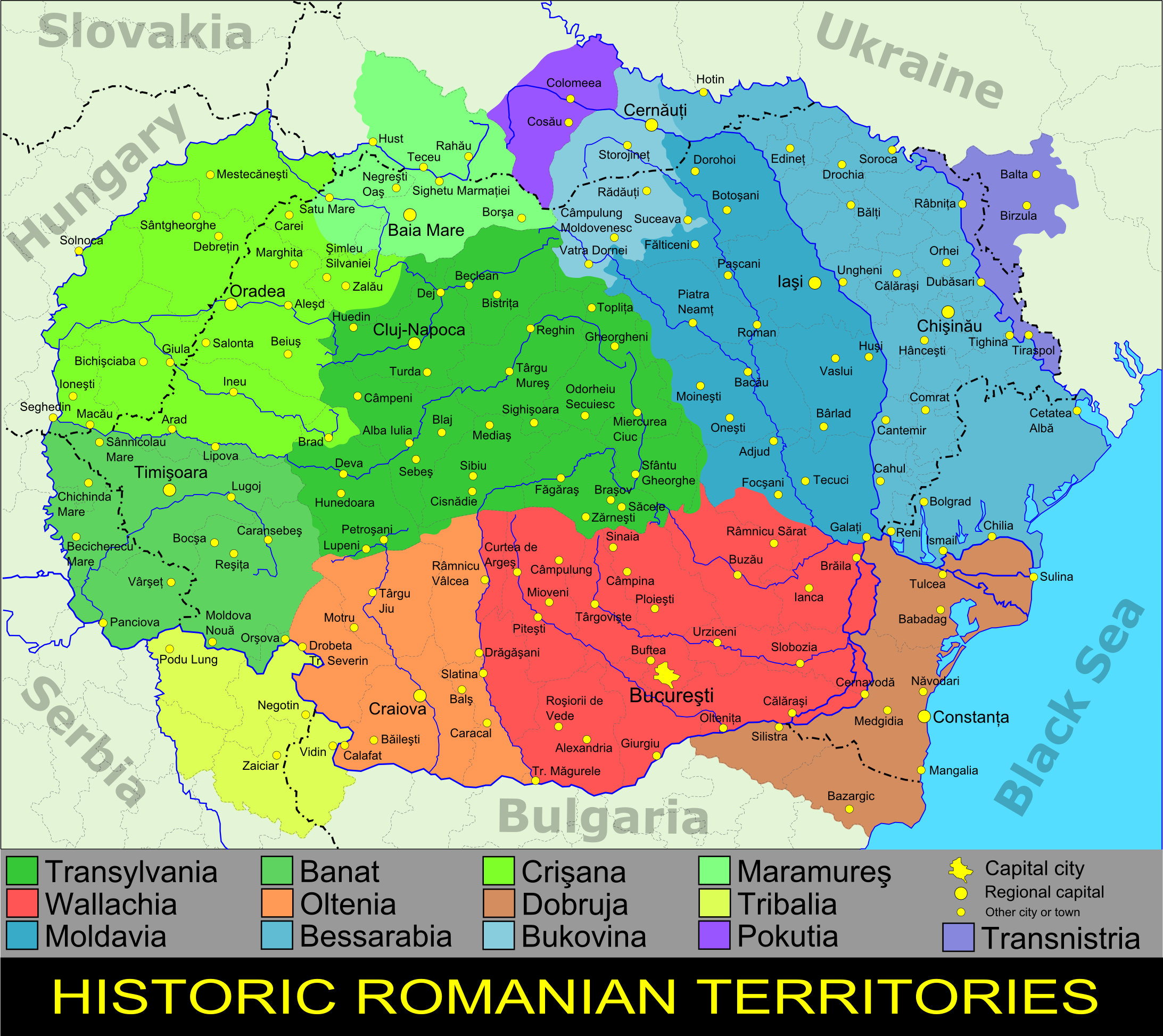
Historical Romanian regions according to contemporary Romanian terminology
The editing of ethnic (ethnographical) maps reached its peak in 1919, during the peace-negotiations following the First World War. Following the completion of the peace-negotiations, the editing and production of ethnic maps became less prevalent in Hungary, as well as in Romania. The next map-making wave occurred in the time period the Second Vienna Award was enacted. From that point onwards, however, it was less intensive, right up until the signing of the Paris Peace Treaties, which closed the period of the Second World War.
In addition to the former Hungarian territories, this blog post also considers regions that have Romanian populations or interest; the areas which were covered in the aforementioned ethnic maps. Moreover, this post also covers ethnic maps of Bukovina (Bucovina, Bukovina), Bessarabia (Basarabia, Бессара́бія, Besszarábia), Budjak/Budzhak (Bugeac, Буджак, Budzsák), Dobrudja/Dobruja (Dobrogea, Dobrudzsa), Southern Dobrudja (Cadrilater, Южна Добруджа, Dél-Dobrudzsa), Transnistria (Transznisztria), Tribalia (Timoc/Valea Timocului, Тимочка kрајина, Timok), Pokuttia/Pokuttya (Pocuția, Pokuttya), as well as maps that focus on the entire territory of the historical Romanian settlement area. Furthermore, this collection covers the maps of the Aromanian or Meglenoromanian settlement areas. This list primarily includes published maps by Romanian authors (not only with Romanian residence). Additionally, a few other maps which were originally edited by non-Romanian cartographers are also displayed below. These maps, were likely published as attachments or as samples from Romanian publications. In some cases, upon viewing, it becomes clearly identifiable that the map was made on Romanian terms. The Romanian ethnic maps showcased in this blog post, predominantly reveal contemporary Romanian territorial concepts.
The most renowned ethnic map that dealt with the Romanian question was a French map. This map was edited by Emmanuel de Martonne, who was the referent of the Romanian question during the peace-negotiations. De Martonne's previous academic research on Romania, as well as his dissertation on Walachia, which was published in 1902, prompted him to map-making. He was very well known and accounted for in Romania at the time. For example, in Cluj-Napoca, there is a street dedicated to Emmanuel de Martonne behind the main building of the Babes-Bolyai University. In a similar vein, a statue was recently inaugurated to his person in Oradea in April of 2019. Despite the fact that de Martonne's map was published in 1919, the wider professional public only came to witness his map when it appeared in the 1920 issue of the leading French geographical review of the time, the Annales de Géographie.
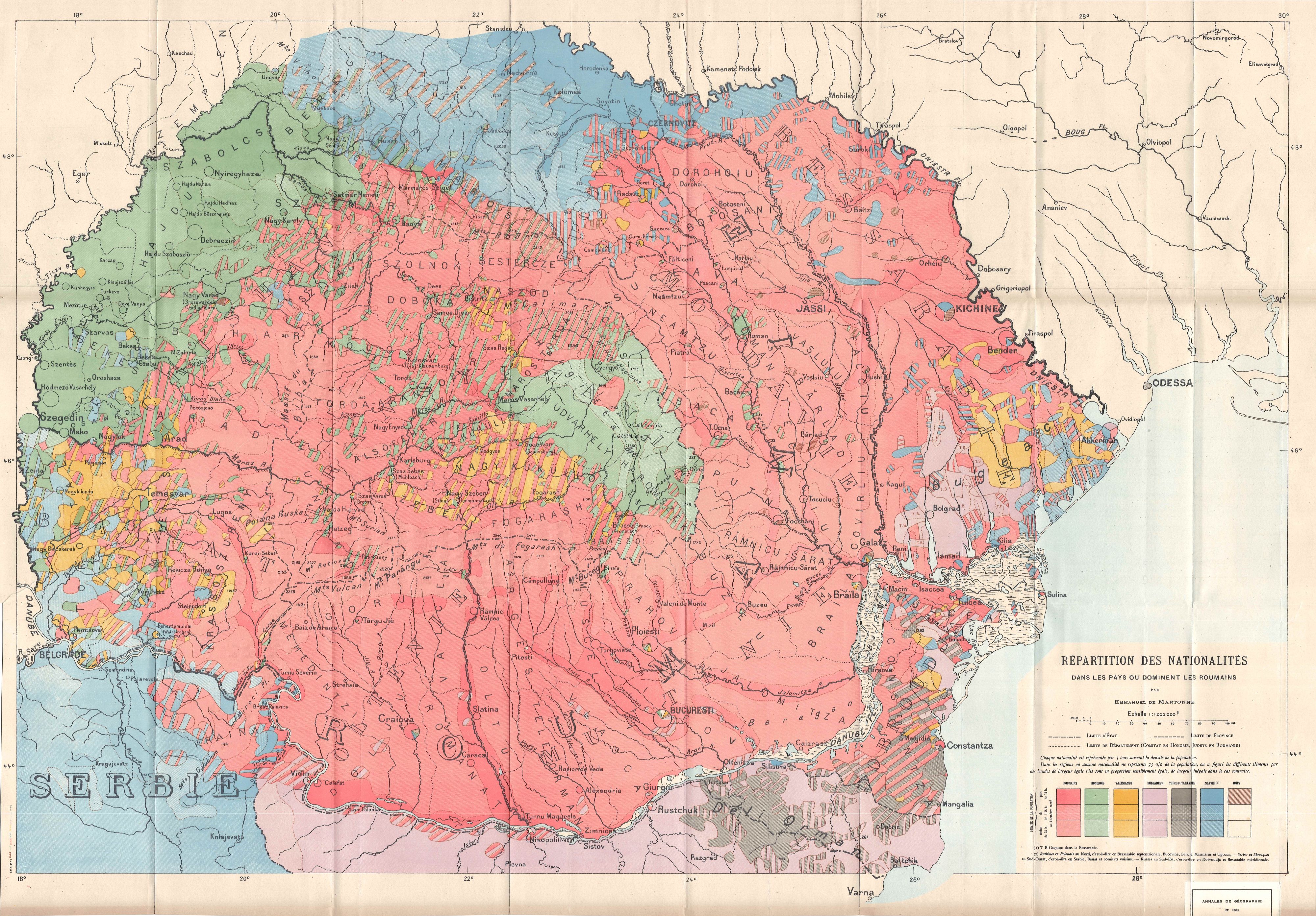
Emmanuel de Martonne: Répartition des nationalités dans les pays ou dominent les Roumains. In: Martonne, Emmanuel de: Essai de carte ethnographique des pays roumains. Annales de Géographie, 1920/158. 81–98. p. 1:1,000,000.
From the author's private collection
In terms of the previous literature on the topic, during the 1940's, many Hungarian cartographic discourses addressed Romanian ethnic maps, as well as the questions they inspired. Moreover, Hungarian territorial revisionist propaganda influenced the creation of Hungarian ethnic maps, and other forms of cartographic literature. The main results of this period from this perspective were not always objective in nature. Some examples are the texts Rumäniche Landkartenfälschungen (1940) and Romanian ethnographical maps and their value (1942) / Die rumänische ethnographische Landkarten und ihre Kritik (1942).
Much later, in 2007, Patrik Tátrai published an exceptional cartographical bibliography entitled: Válogatott bibliográfia Köztes-Európa etnikai földrajzához és etnikai térképezéséhez (1691-2006). This current issue focuses not only on Romania, but also on the bibliographical data related to Romanian ethnic maps.
A part of the presented maps below are quite large with regards to their format. Some occur in sectional sheets. Still others are folded attachments in various publications, or illustrations in both books and atlases. Therefore, most maps included in this list have various physical properties, that in some form, might afford one with a slew of false impressions, the way maps published online have a way of doing. That being said, those who are interested in this topic, would do well to examine the original copies of the maps, for clarity and precision.
The following list is recorded below in chronological order (approximation):
1892
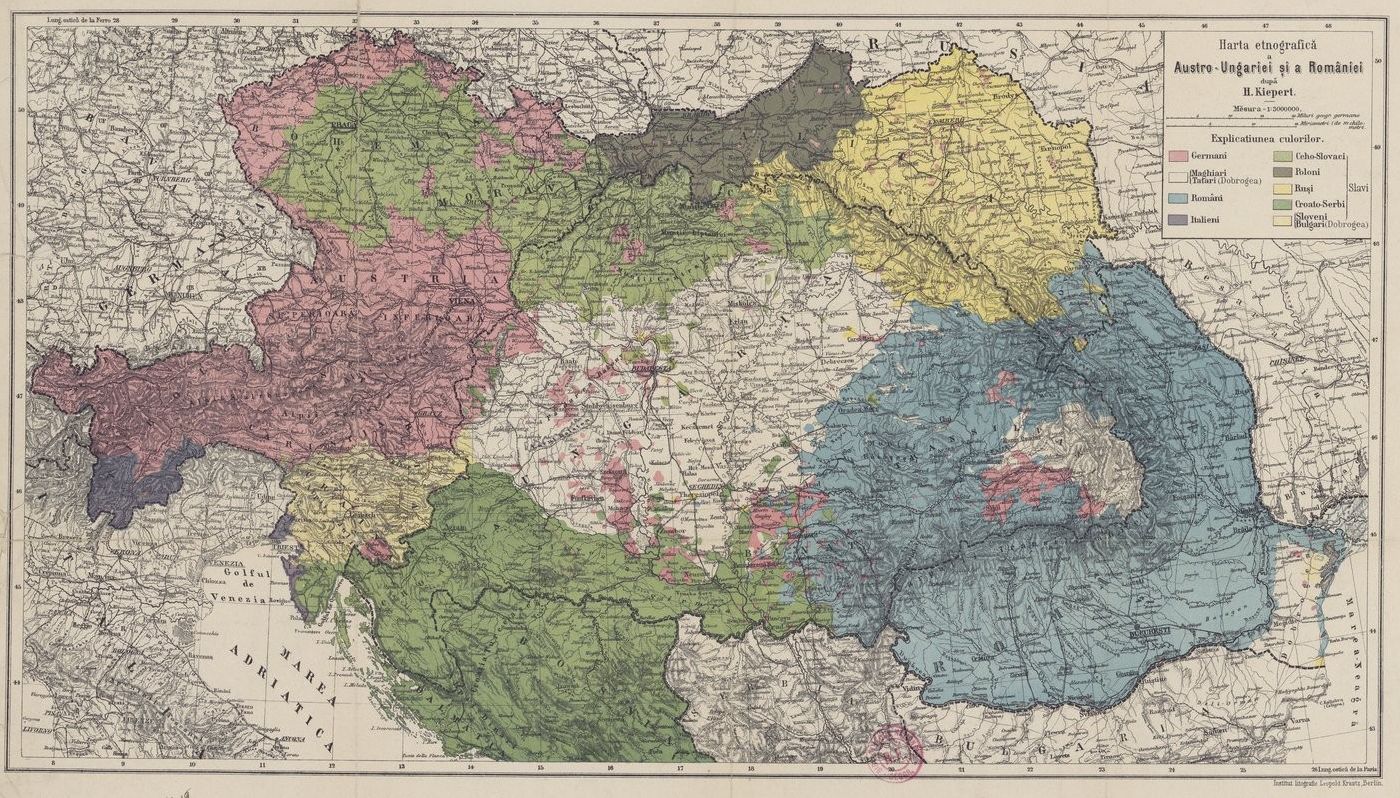
Harta etnografică a Austro-Ungariei şi a României după H. Kiepert. In: Aurel Popovici: La question roumaine en Transylvanie et en Hongrie. Replique de la jeunesse roumainie universitaire de la Trasylvanie et de la Hongrie. Vienna-Graz-Budapest-Kolozsvár/Cluj, 1892. 152 p. 1:3,000,000
1895
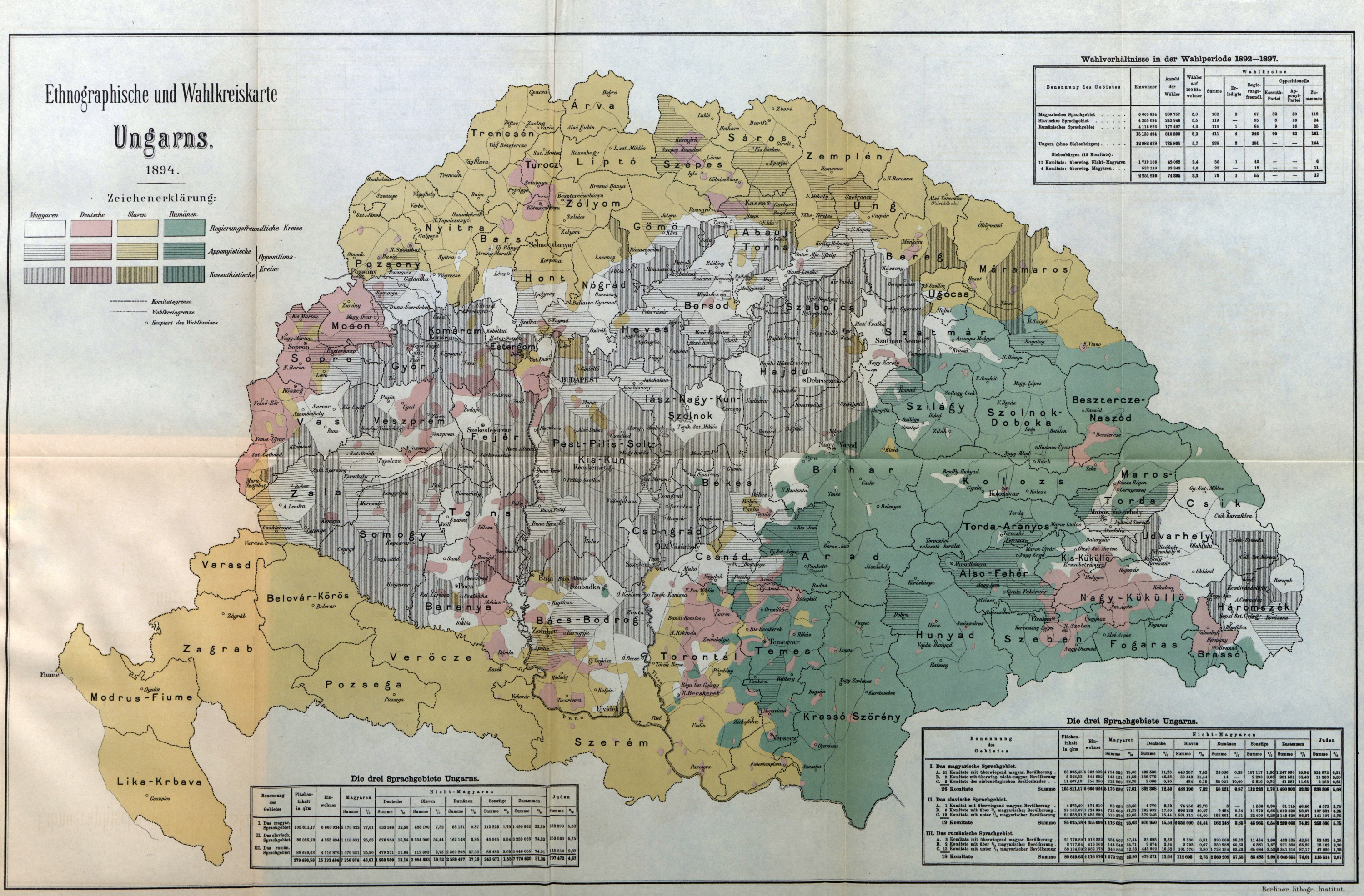
Eugen Brote: Ethnographische und Wahlkreiskarte Ungarns. In: Eugen Brote: Die siebenbürgische Frage in Siebenbürgen und Ungarn. Berlin, Puttkammer & Mühlbrecht, 1895. 432. p. m. n.
From the author's private collection
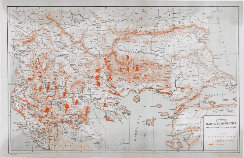
Ioan Nenițescu: Harta etnografică a armânilor din Turcia Europeană. 1895. In: Ioan Nenițescu: De la Romanii din Turcia europeana. Bukarest, Institutul de Arte Grafice Carol Göbl, 1895. 639. p.
1903
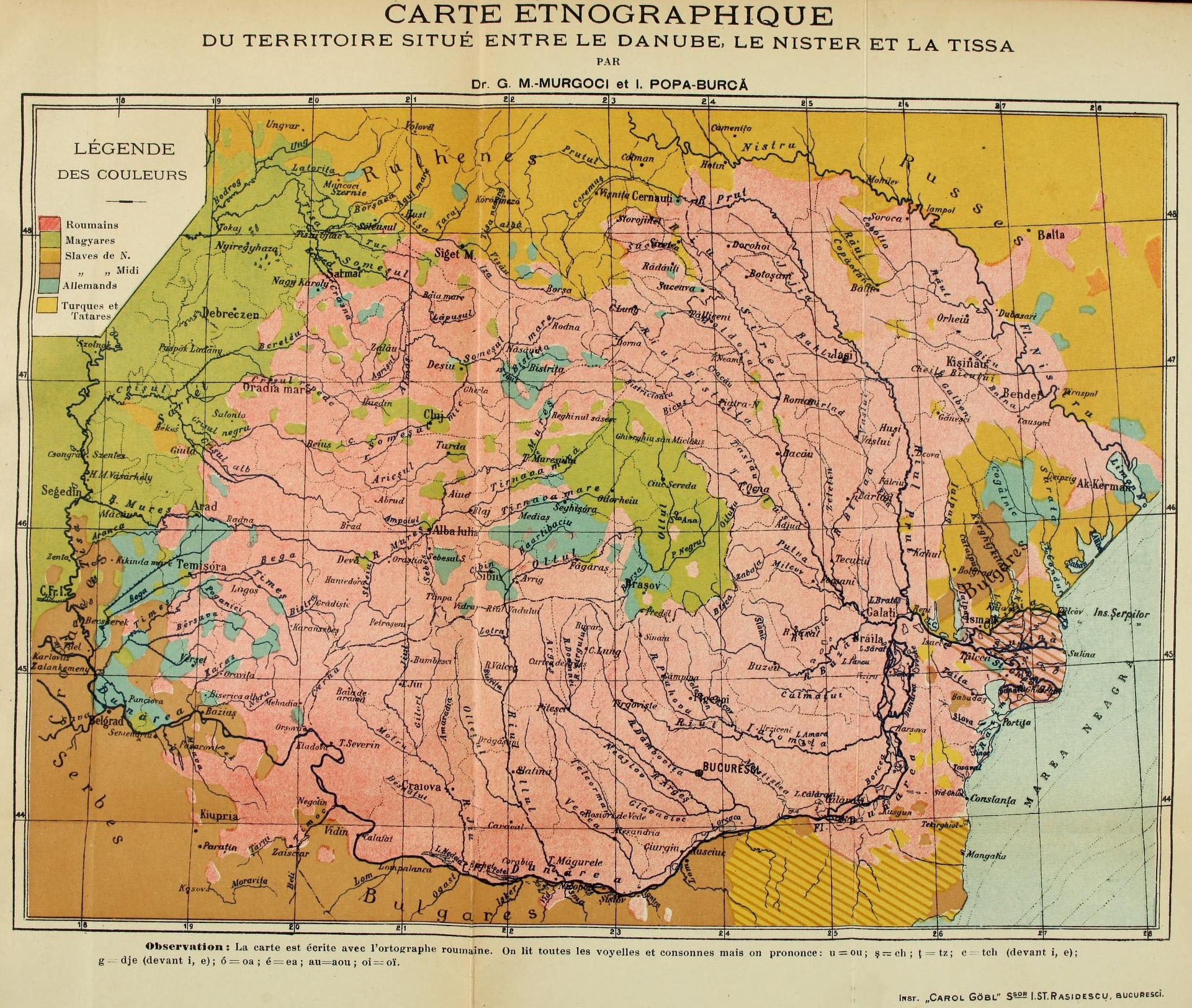
G. M. Murgoci - I. Popa-Burcă: Carte ethnographique du territorie suité entré le Danube, le Nister et la Tissa. In: A. Vlahoutza: La Roumanie pittoresque. Bukarest, "Indépendance Roumaine", 1903. 330. p. m. n.
1904
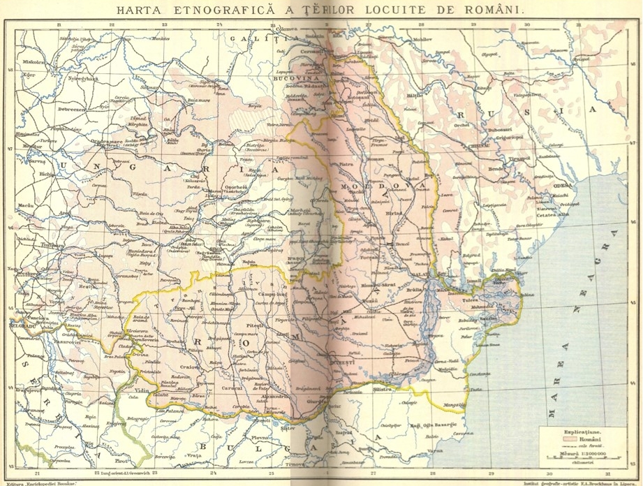
Diaconovich, C.: Harta etnografică a terilor locuite de români. In: Diaconovich, C.: Enciklopedia Română. Nagyszeben/Sibiu, ASTRA, 1904. 1274 p. 1:3,000,000.
Source: private collection
1909
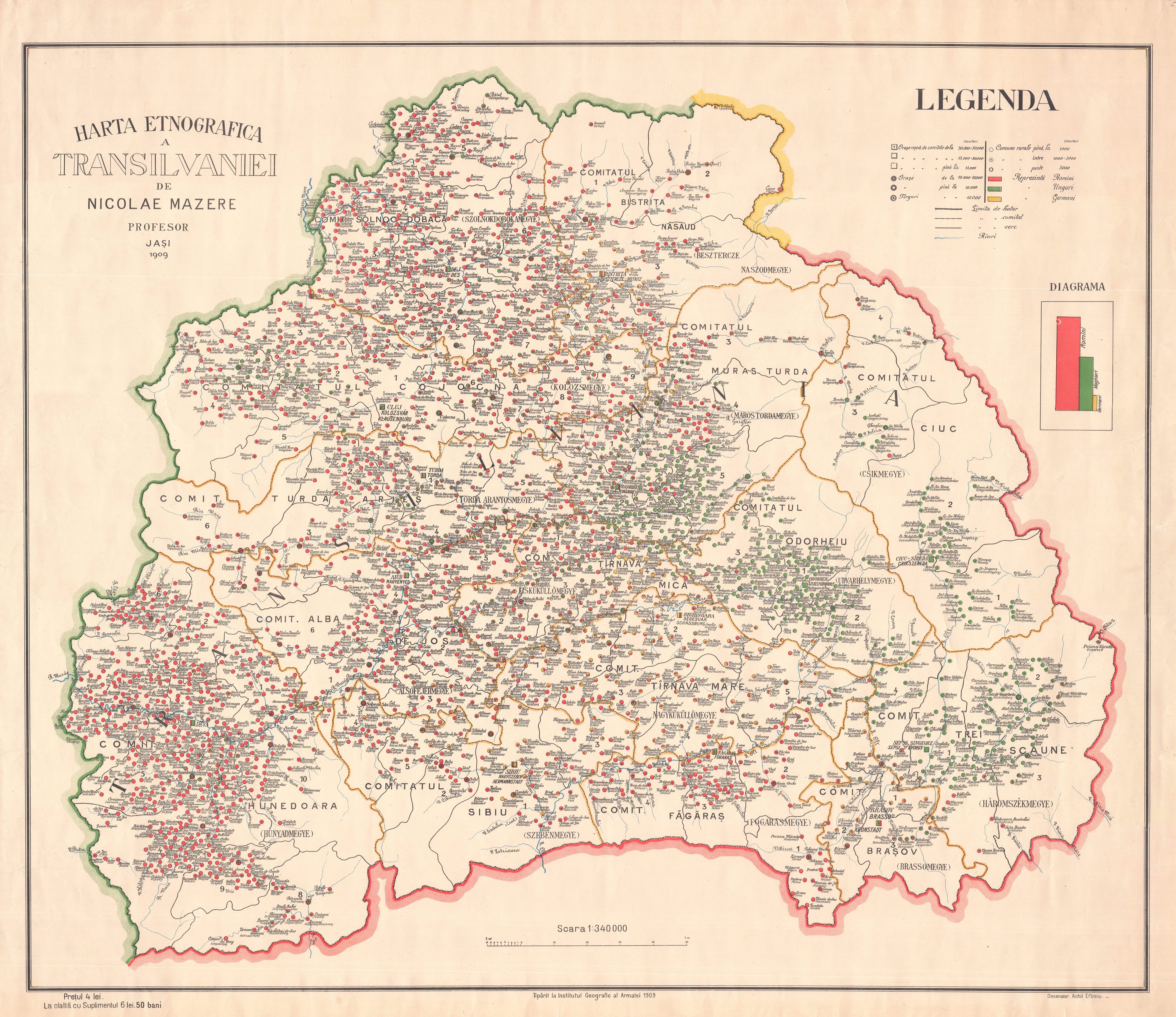
Nicolae Mazere: Harta etnografica a Transilvaniei. + Nicolae Mazere: Supliment la harta etnografică a Transilvaniei. Iași, Institutul Geografic al Armatei, 1909. 98. p. 1:340,000.
From the author's private collection
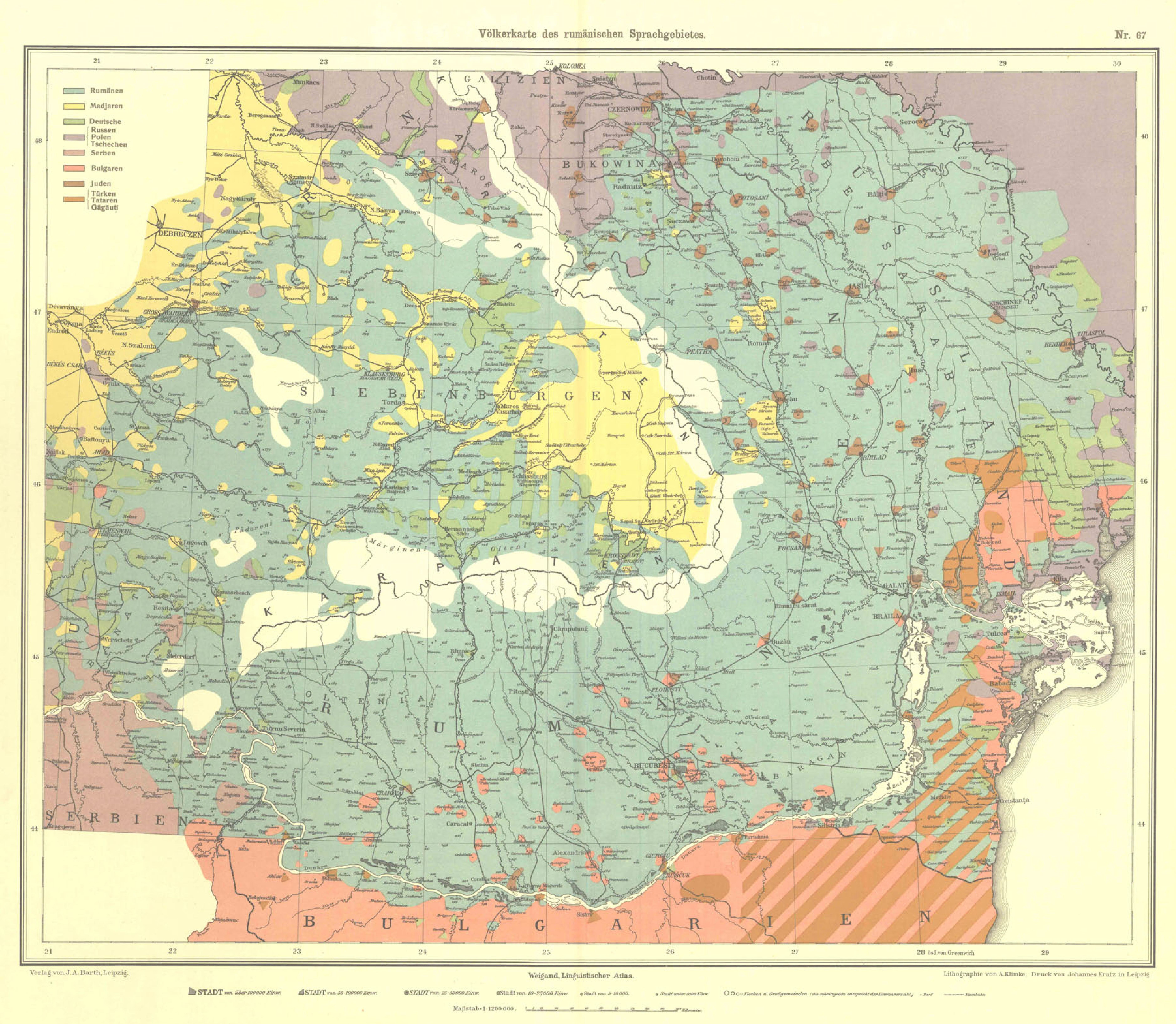
Prof. Dr. Gustav Weigand: Völkerkarte des rumänischen Sprachgebietes. In: Prof. Dr. Gustav Weigand: Linguistischer Atlas des dacorumänischen Sprachgebietes herausgeben auf Kosten der Rumänischen Academie in Bukarest. Leipzig, Johann Ambrosius Barth, 1909. 67. p.
Source: private collection
1914
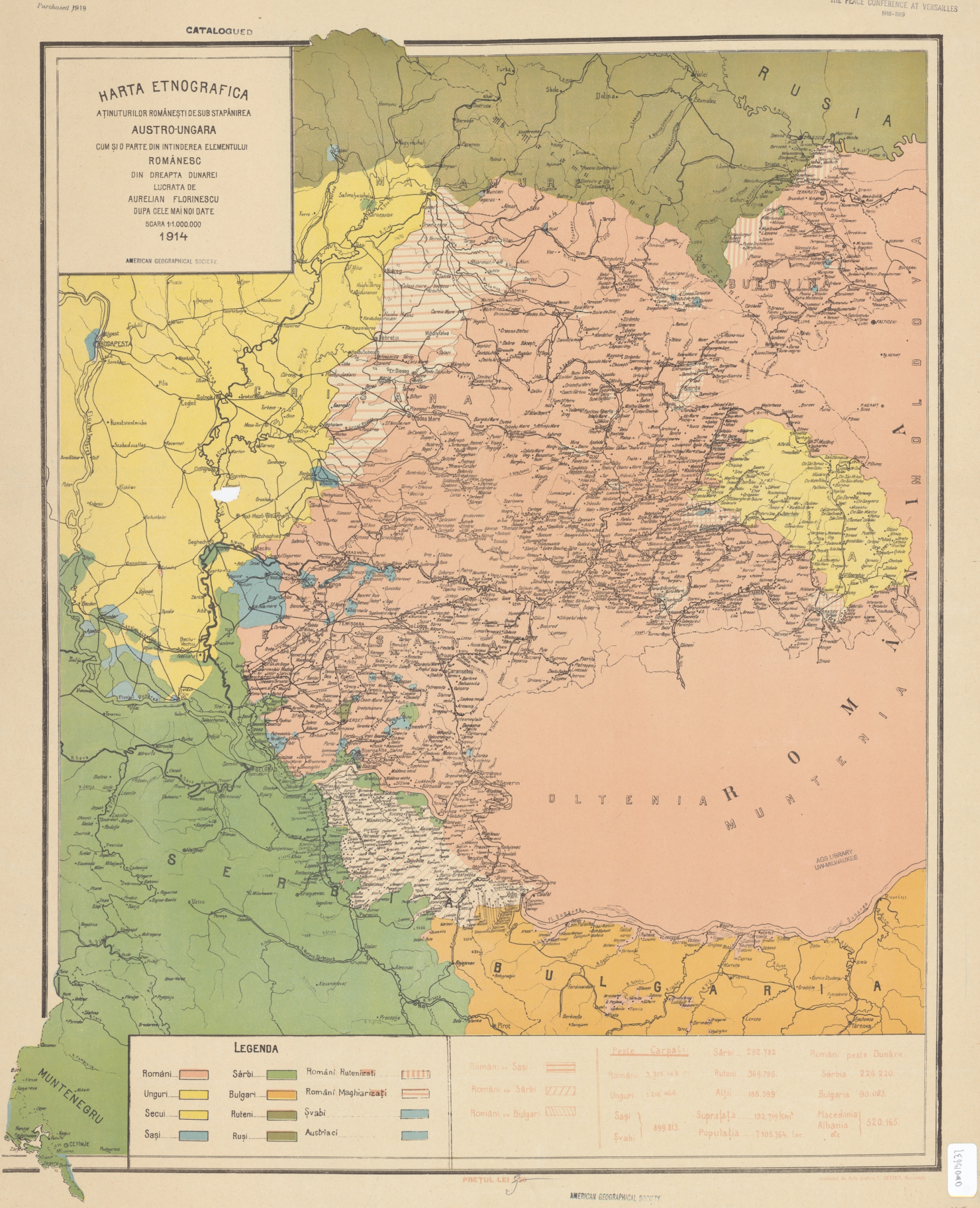
Aurelian Florinescu: Harta etnografica a ținuturilor Românești de sub stapánirea Austro-Ungara cum și parte din intinderea elementului Românesc. Bucharest, 1914. 1:1,000,000.
Source: American Geographical Society Library, University of Wisconsin-Milwaukee Libraries, 666-c.W4 C-1914 (Milwaukee)
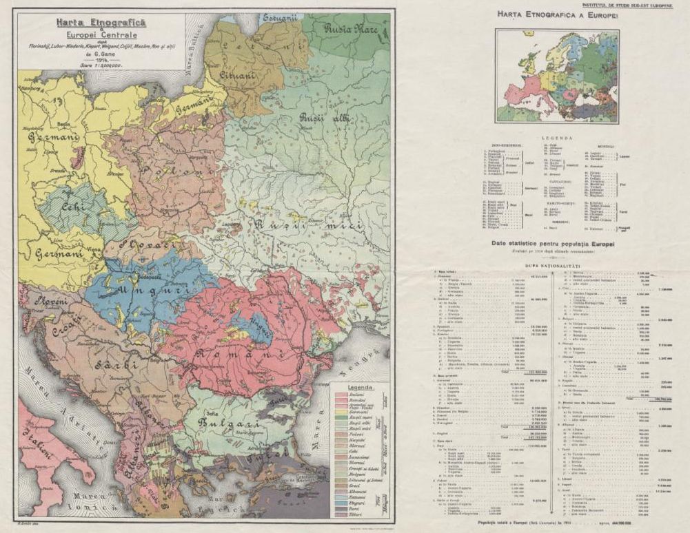
G. Gane: Harta etnografică a Europei Centrale după Florinskij, Lubor-Niederle, Kiepert, Weigand, Cvijić, Mazăre, Noe şi alţii. Bucharest, Institutul de studii Sud-est Europene, 1914.
Source: National Széchenyi Library, Map Collection, TM 7189 (Budapest)
1915
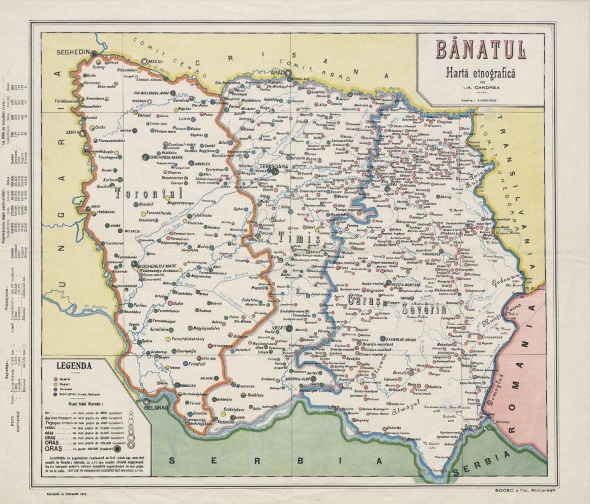
Ion Aurel Candrea: Bănatul. Hartă etnografică. 1915. 1:500,000
Source: National Széchenyi Library, Map Collection, TM 7189 (Budapest)
1916
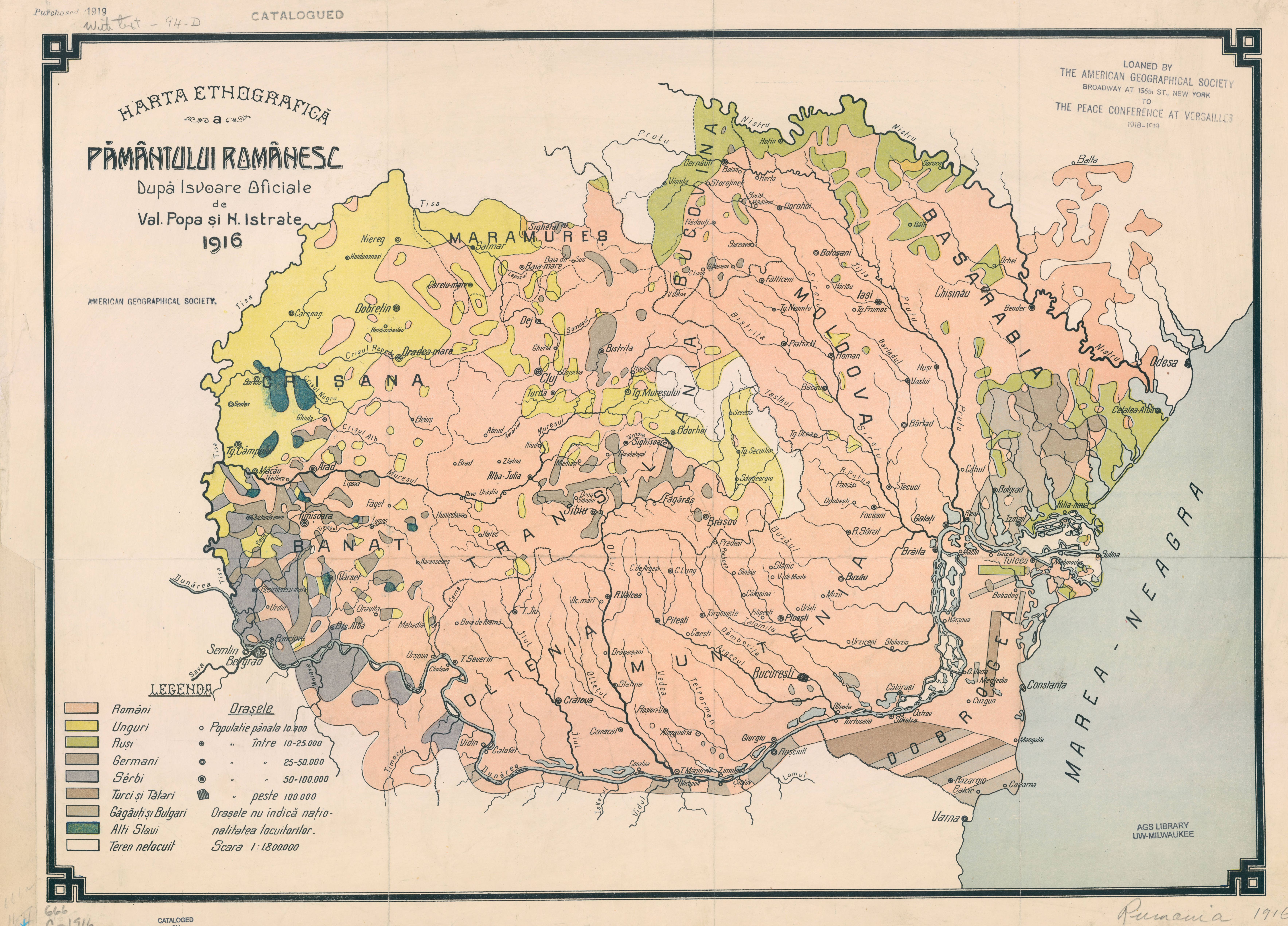
Val Popa - N. Istrate: Harta etnografică a pământului Românesc. 1916. 1:1,800,000
Source: American Geographical Society Library, University of Wisconsin-Milwaukee Libraries,666 C-1916 (Milwaukee)
1918
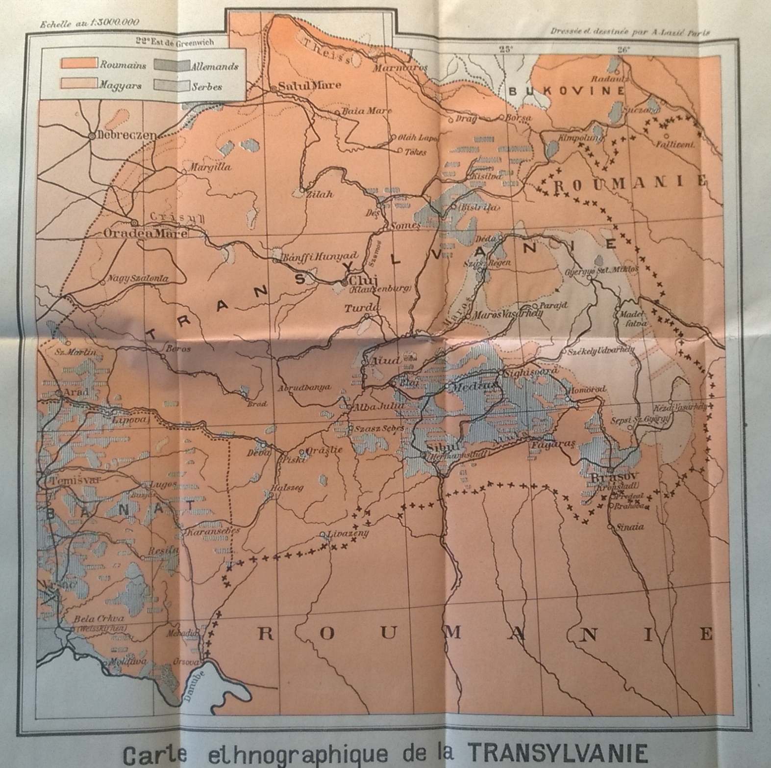
Dargicesco: Carte ethnographique de la Transylvanie. In: Dragicesco: La Transylvanie. Esquisse historique géographique, ethnographique et statistique. Paris, Librarie Félix Alcan, 1918. 112. p. 1:3,000,000.
Source: Archives diplomatiques, Ministère des Affaires étrangères Direction des Archives Fonds du service géographique 294 QO / 81 (Paris)
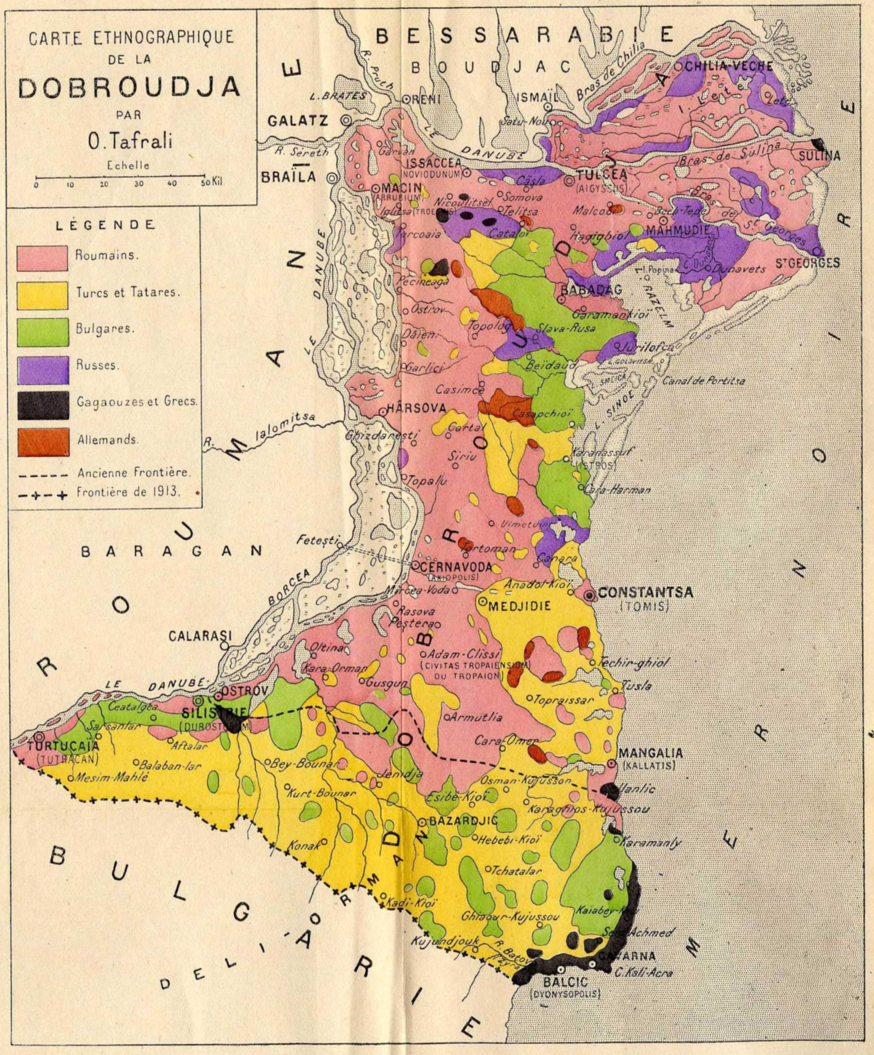
O. Tafrali: Carte Ethnographique de la Dobroudja. In: O. Tafrali: La Roumanie Transdanubienne (La Dobroudja). Paris, Ernest Leroux,1918. 195. p. m. n.
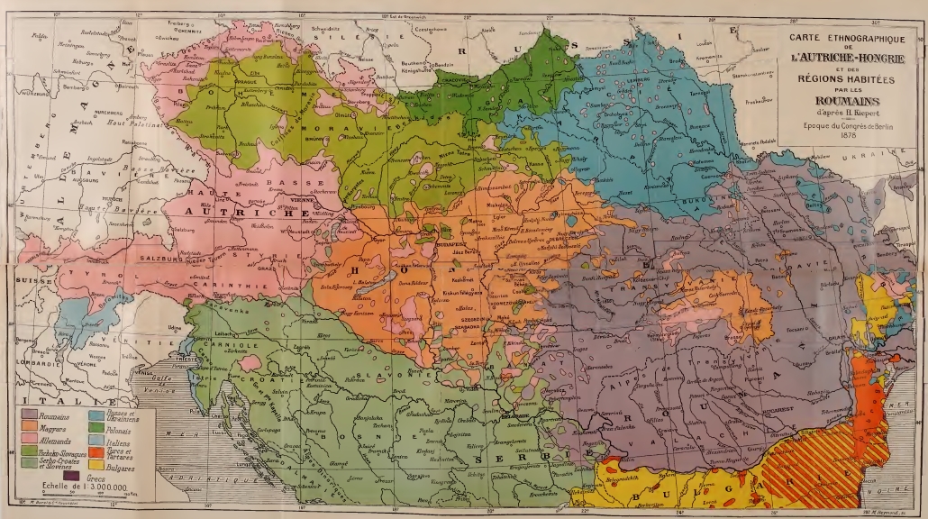
Carte Ethnographique de L'Autriche-Hongrie et des regions habitées par les Roumains d'aprés H. Kiepert. In: Aurele C. Popovici: La question roumaine en Transylvanie et en Hongrie; avec plusieurs tableaux statistiques et une carte ethnographique. Paris-Lausanne, Payot & Cie, 1918. 230. p. 1:3,000,000.
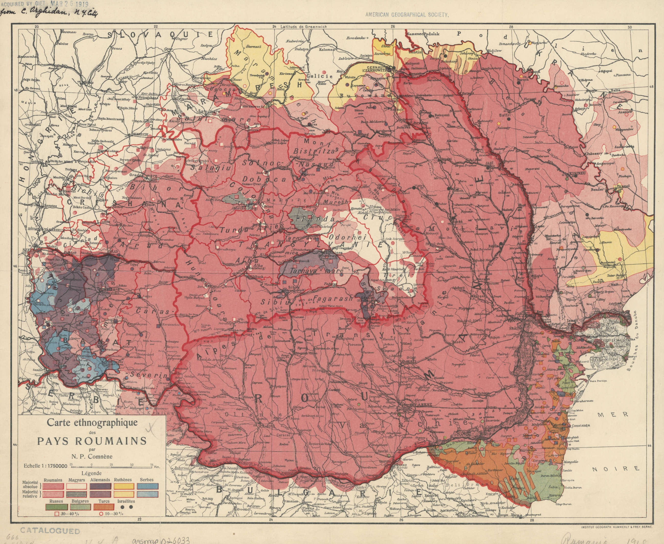
N. P. Comnene: Carte ethnographique des Pays Roumains. 1918? Bern, Institut Géograph. Kummerly & Frey, 1:1,750,000.
Source: American Geographical Society Library, University of Wisconsin-Milwaukee Libraries, 666 C-[1918] (Milwaukee)
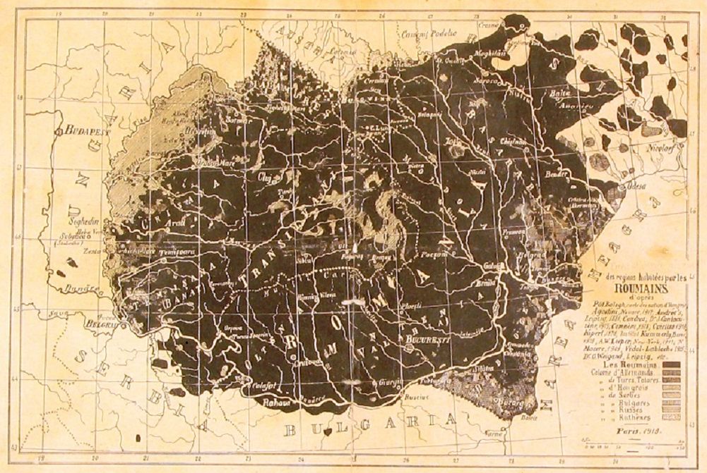
A. D. Atanasiu: des regions habitées par les Roumains. Paris, 1918
1919
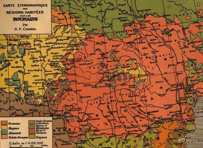
N. P. Comnéne: Carte Ethnographique des Régions Habitées par les Roumains. In: N. P. Comnéne: La terre roumaine à travers les âges : Atlas historique, politique ethnographique. Payot et Cie, Paris. 1919. 57. p. 1:4,150,000.
Source: Archives diplomatiques, Ministère des Affaires étrangères Direction des Archives Fonds du service géographique 294 QO / 81 (Paris)
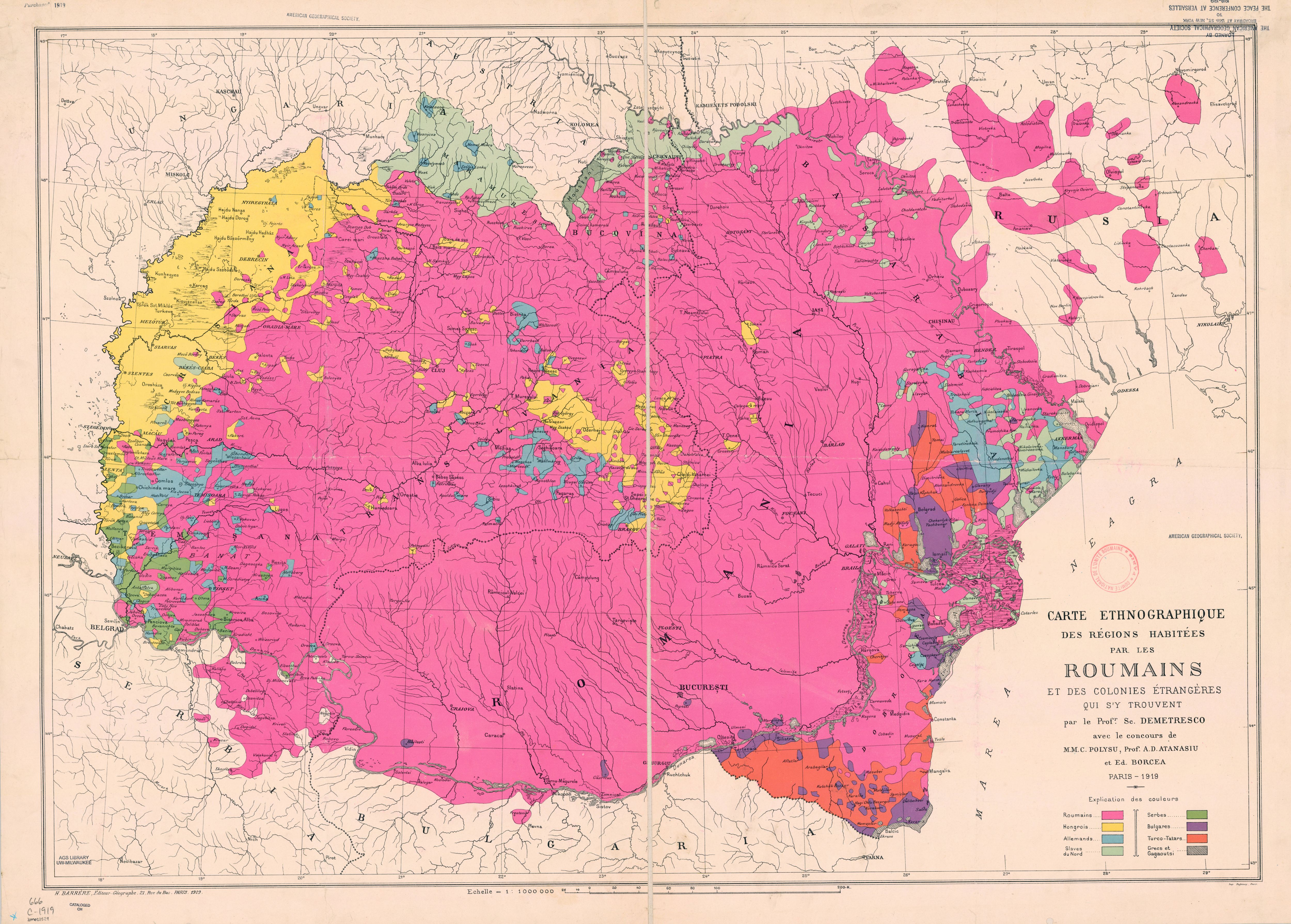
Demetresco: Carte ethnographique des régions habitées par les Roumains. Paris, H. Barrère, Éditeur-Géographe, 1919. 1:1,000,000
Source: American Geographical Society Library, University of Wisconsin-Milwaukee Libraries, 666 C-1919 (Milwaukee)
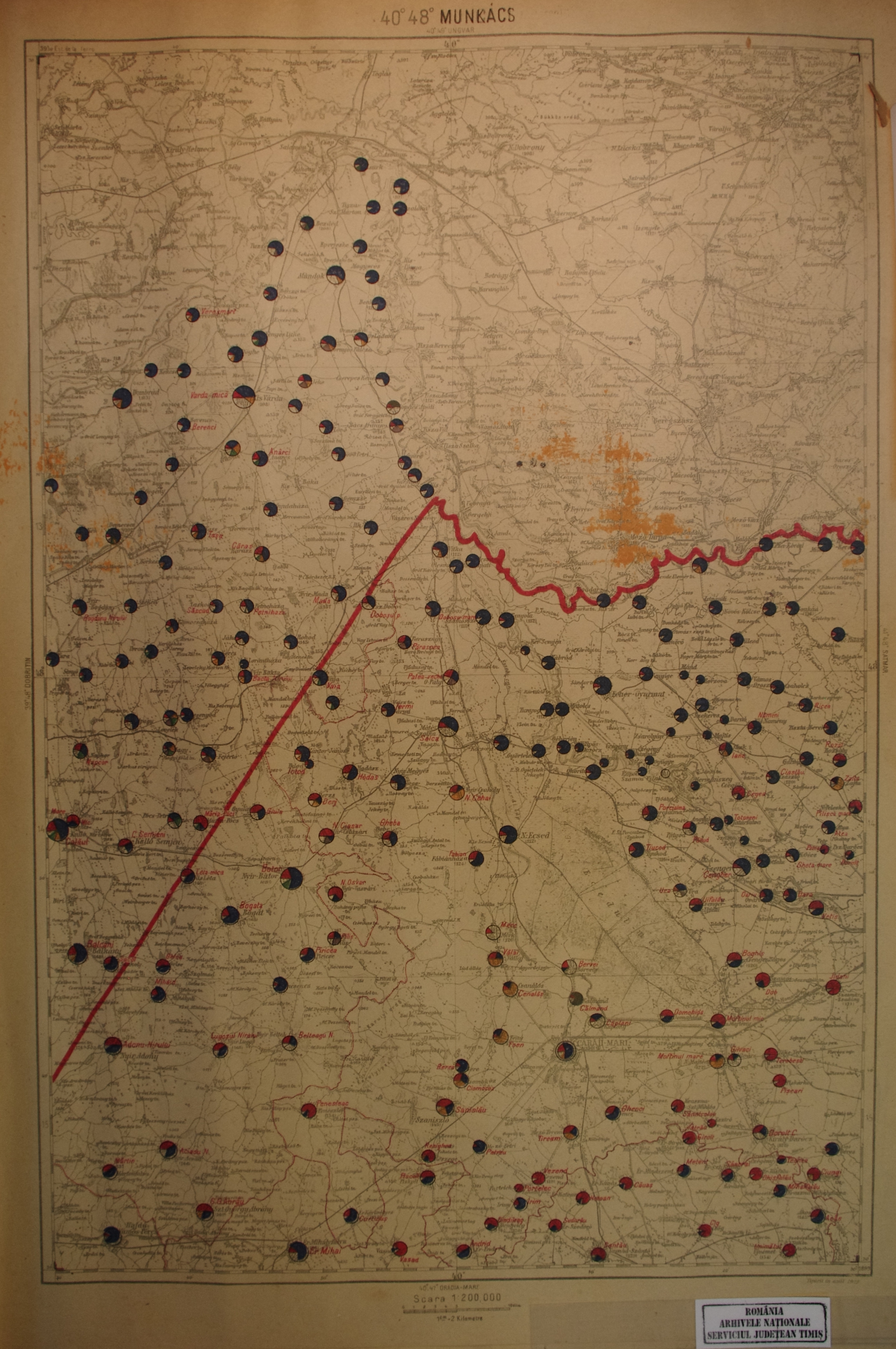
Vasile Meruţiu: România Dintre Tisa şi Carpați Transilvania, Maramurăsul, Țara Crisului şi Bănatul. Hartă etnografică. Bucharest, Serviciul Geografic al Armatei, 1919. 28 sheets, 1:200,000.
Source: Arhivele Nationale Timiș, Fond 104, inventar 210, Collectia harti și planuri, 8/1919 (Timisoara)
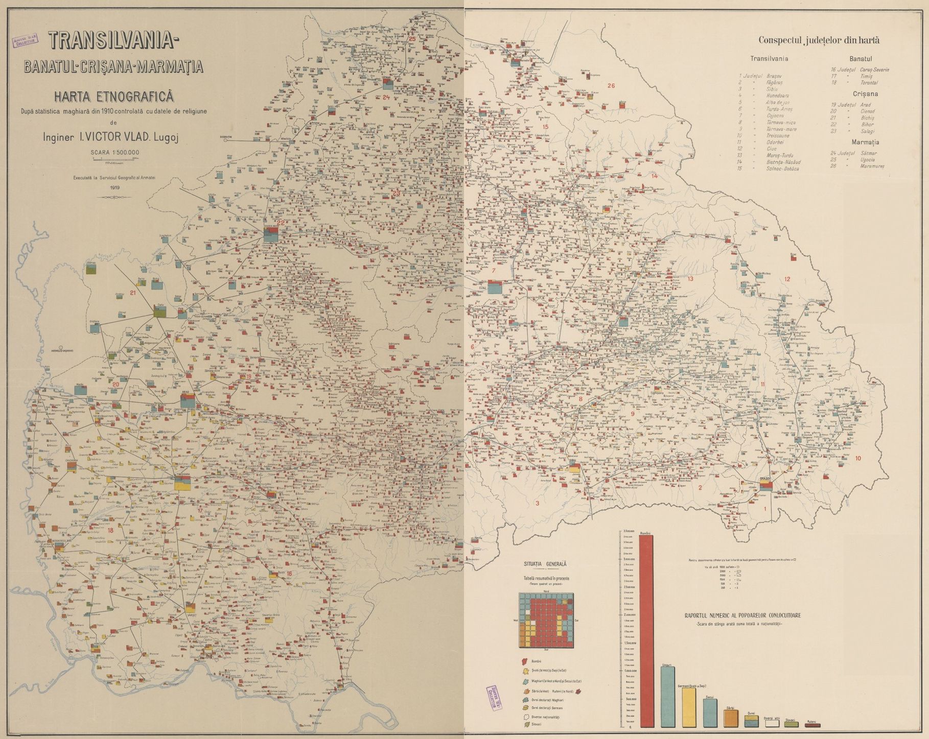
I. Victor Vlad: Transilvania-Bănatul-Crişana-Marmaţia: Hartă Etnografică. Bucharest, Serviciul Geografic al Armatei, 1919. 2 sheets, 1:500,000.
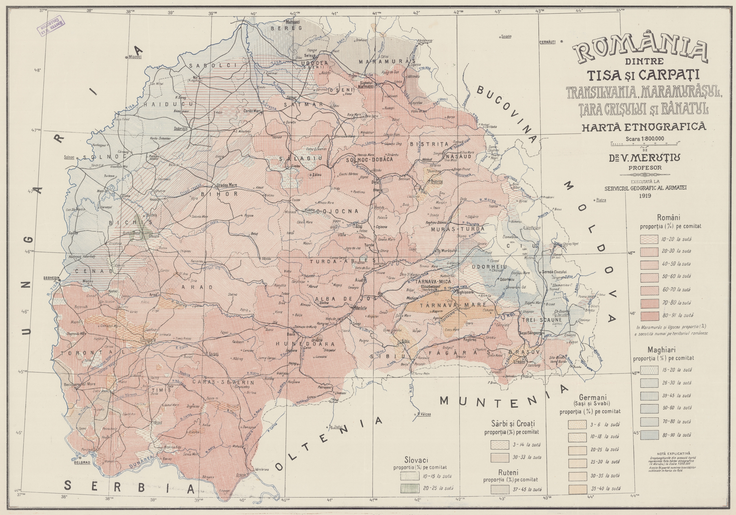
Vasile Meruțiu: România dintre Tisa şi Carpaţi Transylvania, Maramarosul, Tara Crisului si Banatul. Harta etnografica. Bucharest, Serviciul Geografic al Armatei, 1919. 1:800,000.
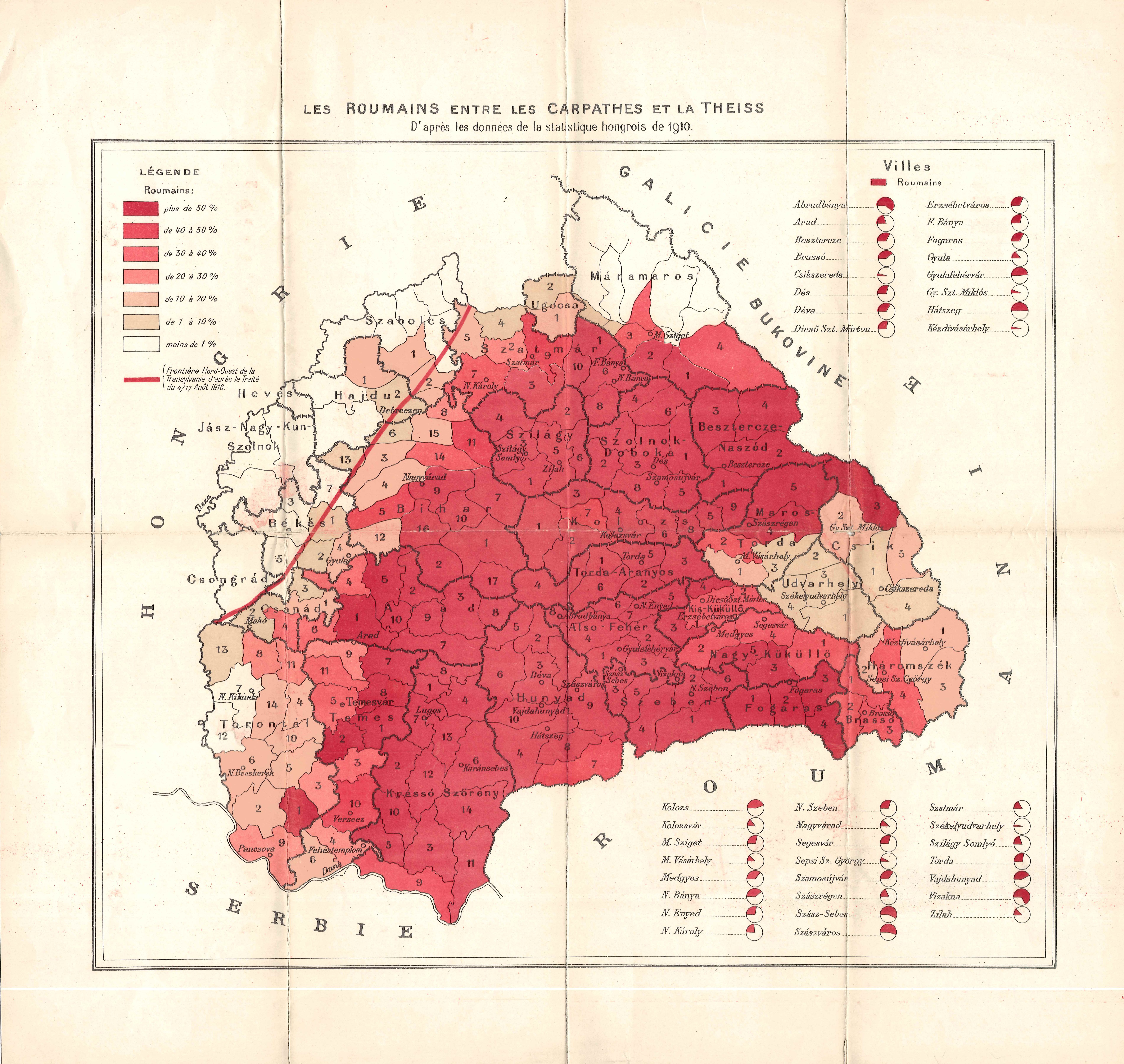
Les Roumains entre les Carpathes et la Theiss. 1919.
From the author's private collection
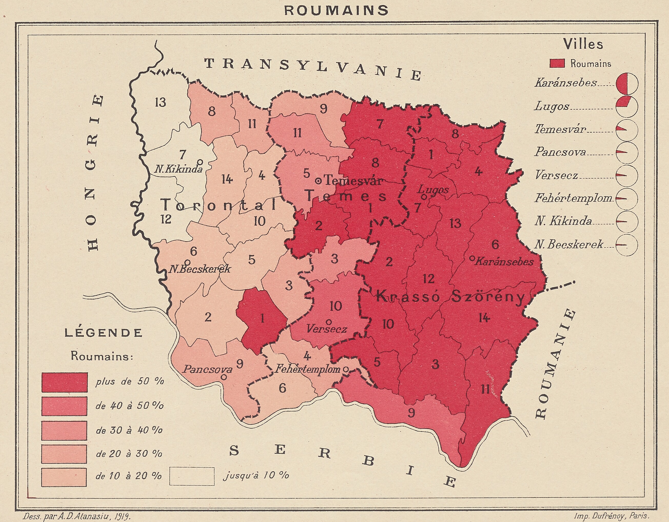
A. D. Atanasiu: Roumains. Paris, Dufrénoy, 1919. m. n. (other sheets of the series: Allemands, Magyars, Serbes)
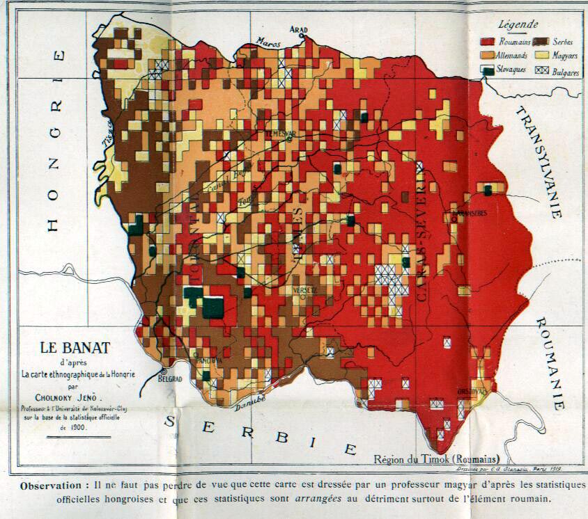
Atanasiu: Le Banat d'aprés la carte ethnographique de la Hongrie pa Cholnoky Jenő. In: La Bucovine et le Banat. Paris, Libarié Félix Alcan, 1919. 54. p. m. n.
Source: Archives diplomatiques, Ministère des Affaires étrangères Direction des Archives Fonds du service géographique 294 QO / 81 (Paris)

A. D. Atanasiu: Carte ethnographique du Banat de Temesvar. Paris, Imp. Monroco, 1919. 1:1,000,000.
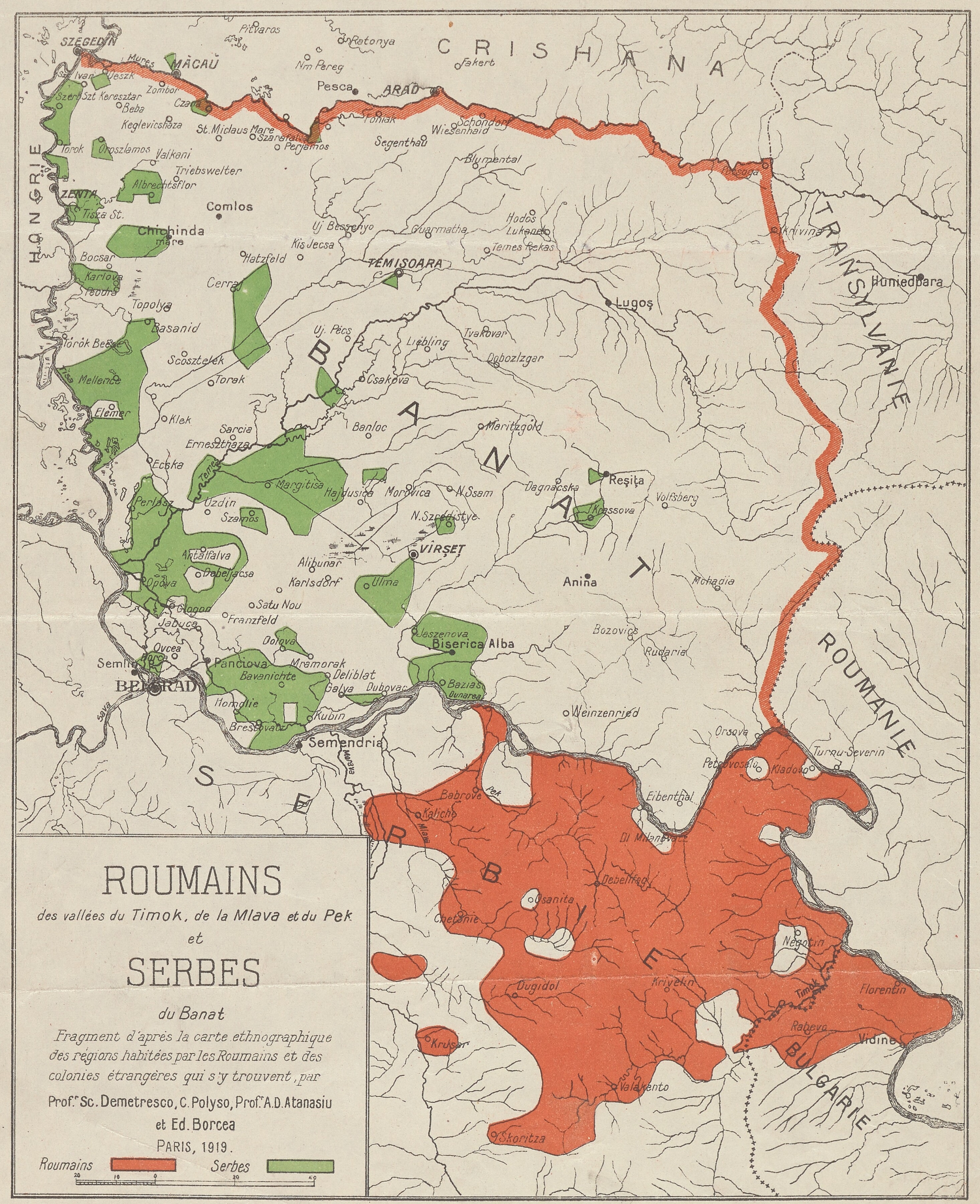
Sc. Demetresco - C. Polyso - Prof. A. D. Atanasiu - Ed. Brocea: Roumains des vallées du Timok, de la Mlava et du Pek et Serbes du Banat. Paris, 1919.
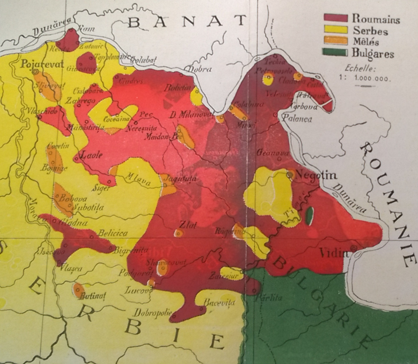
A. D. Atanasiu: Les Roumains de Serbie (Région du Timok et de la Morave) d'aprés G. Valsan & G. Giuglea. In: D. Dragicesco: Les Roumains de Serbie. Paris, 1919. 1:1,000,000
Source: Archives diplomatiques, Ministère des Affaires étrangères Direction des Archives Fonds du service géographique 294 QO / 81 (Paris)
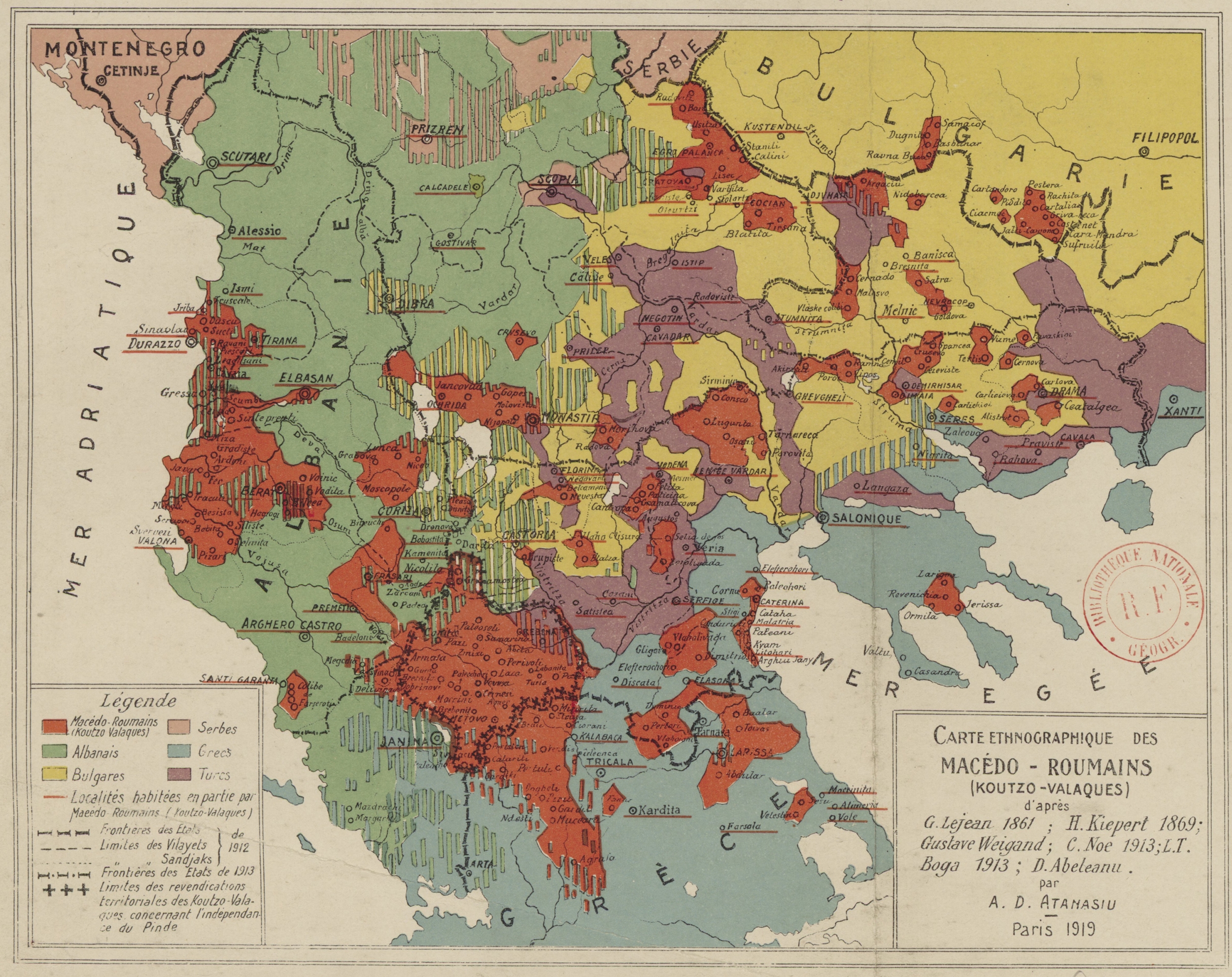
A. D. Atanasiu: Carte ethnographique des Macédo-Roumains (Koutzo-Valaques). k. n., Paris, 1919. m. n.
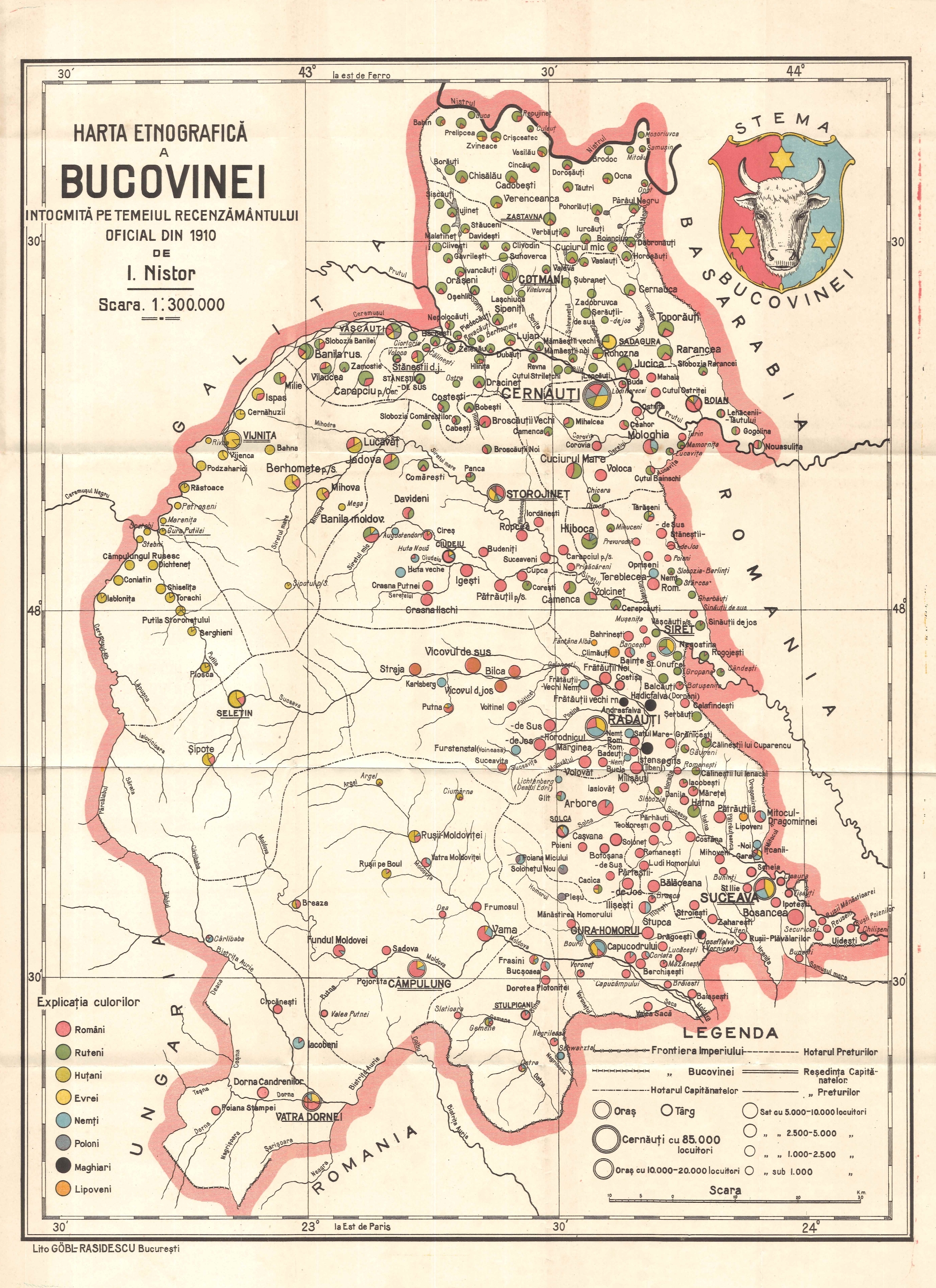
I. Nistor: Harta etnografica a Bucovinei. In: I. Nistor: Der nationale Kampf in der Bukowina mit besonderer Berücksichtigung der Rumänen und Ruthenen. Bucharest, Göbl, 1919. 227. p. 1:300,000.
From the author's private collection
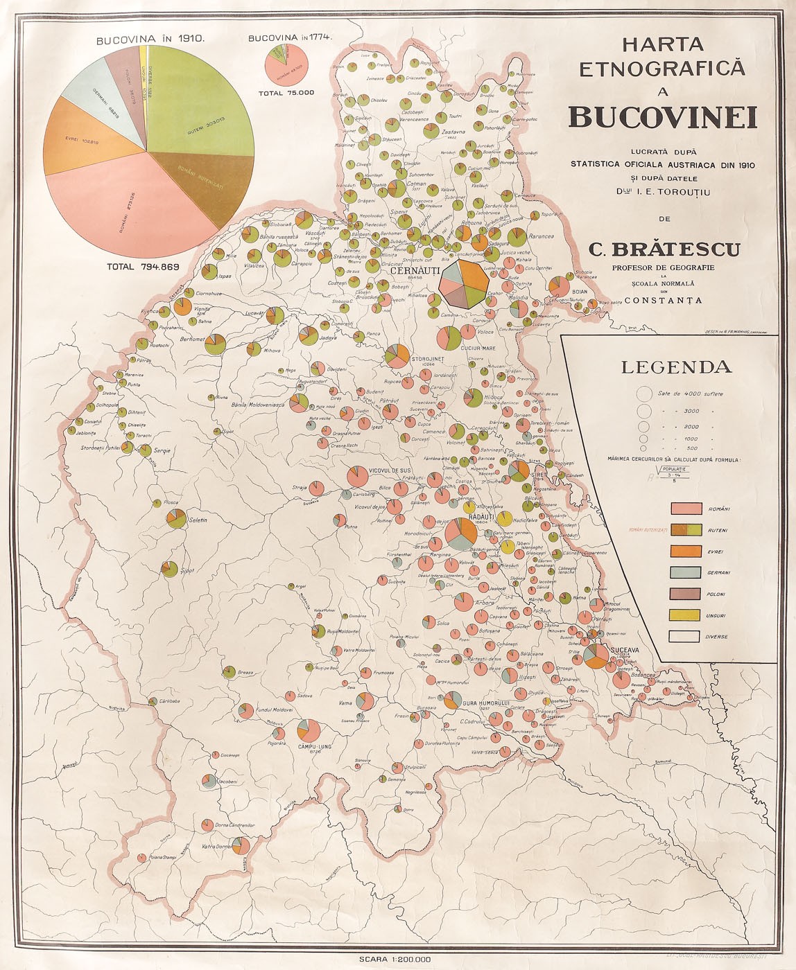
C. Brătescu: Harta etnografică a Bucovinei, lucrată după statistica oficială austriacă din 1910. Bucharest, Göbl-Rasidescu, 1:200,000.
Source: private collection
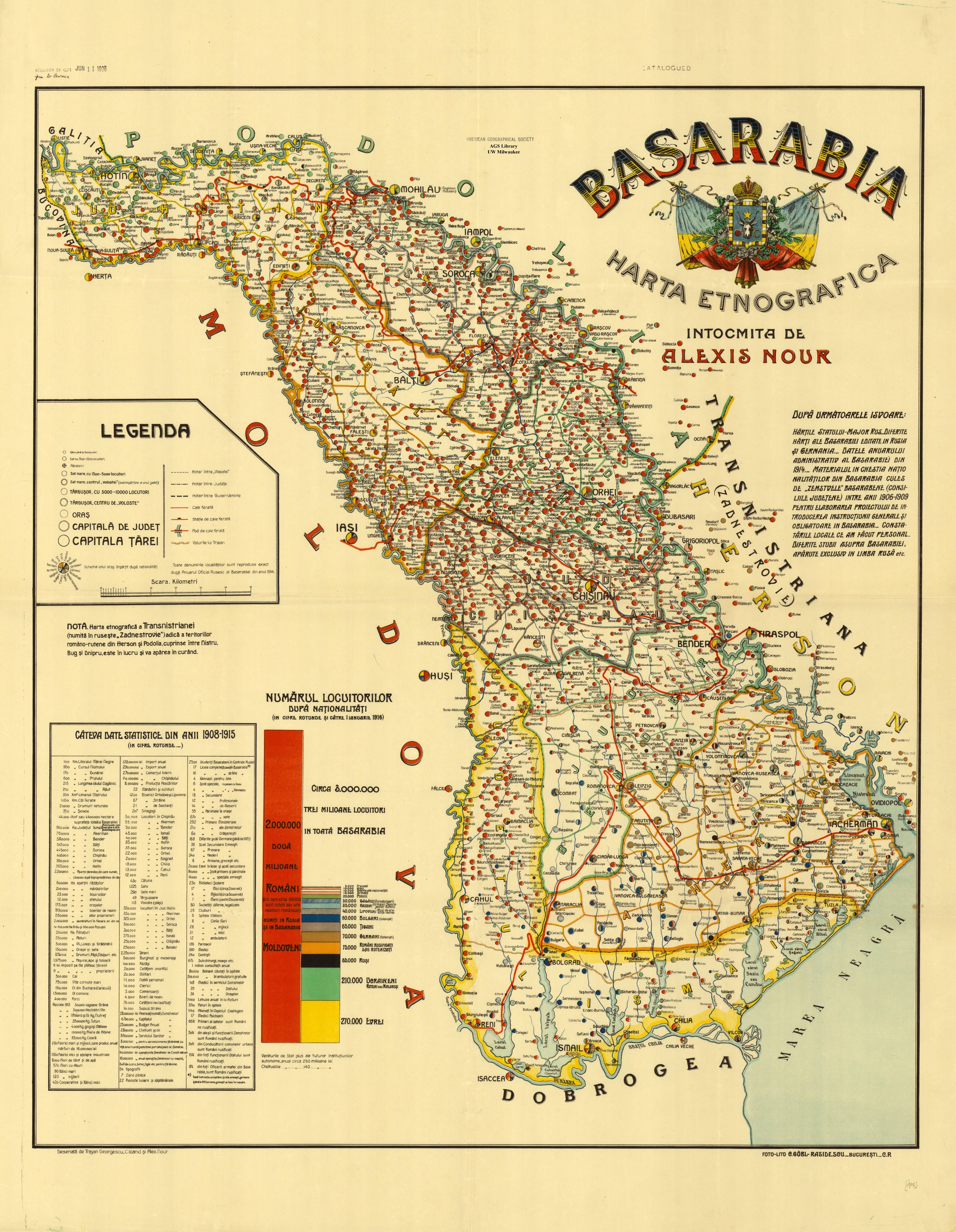
Alexis Nour: Basarbia. Harta Etnografica. Bucharest, Göbl, 1919. 1:460,000.
Source: American Geographical Society Library, University of Wisconsin-Milwaukee Libraries, 687-c .B47 C-[1919]a (Milwaukee)
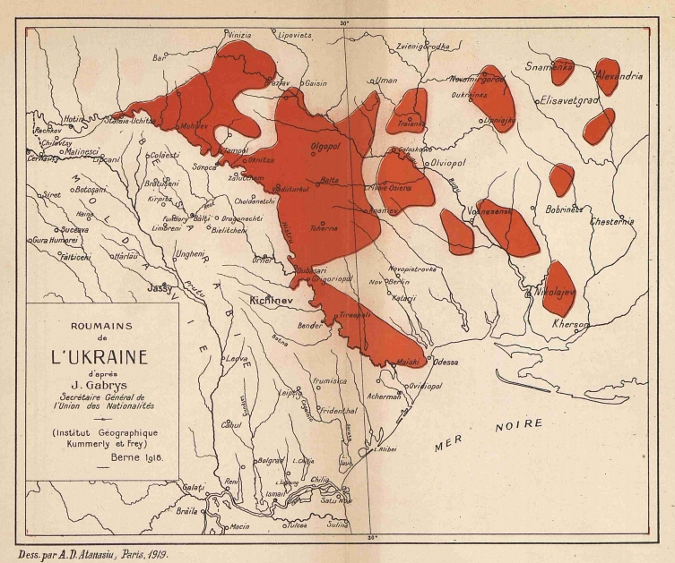
A. D. Atanasiu: Roumains de l'Ukraine. 1919. m. n. In: D. Draghicesco - Murgoci: Les roumains d'Ukraine. Paris, Dubois et Bauer, 1919. 27 p.
1920
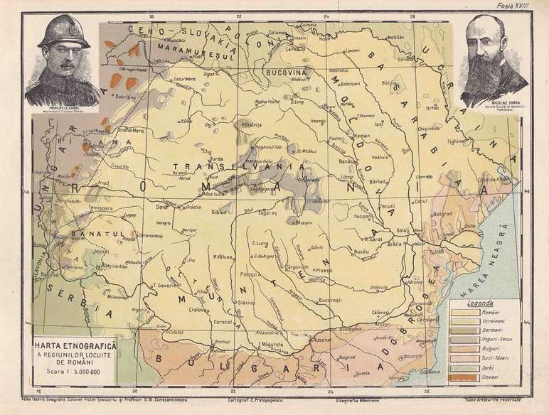
C. Protopopesu: Harta etnografică a regiunilor locuite de Români. In: Colonel Victor Siaicanu - D. St. Constatinescu: Atlas istoric geografic al neamului Românesc. Bucharest, 1920. 26 p. 1:3,000,000.
1922
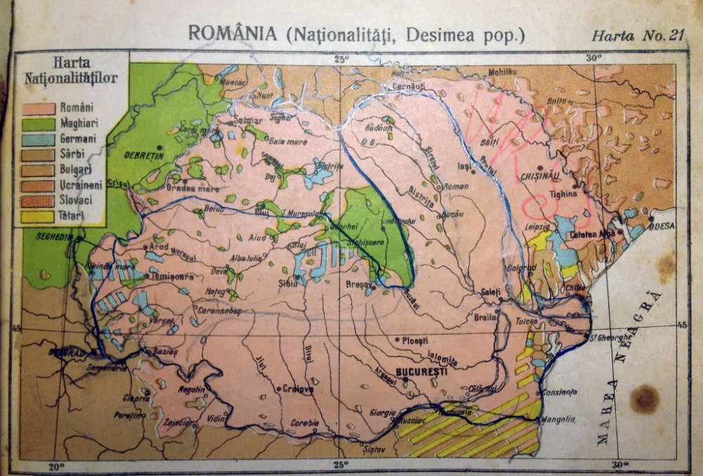
România (Naționalițăti, Desimea pop.) In: I. Popa-Burca: Atlas Geografic. Bucharest, 1922. m. n.
1923

Alexis Nour: Transnistriana. Carte éthnographique. 1923. 1:700,000.
Source: private collection
1928
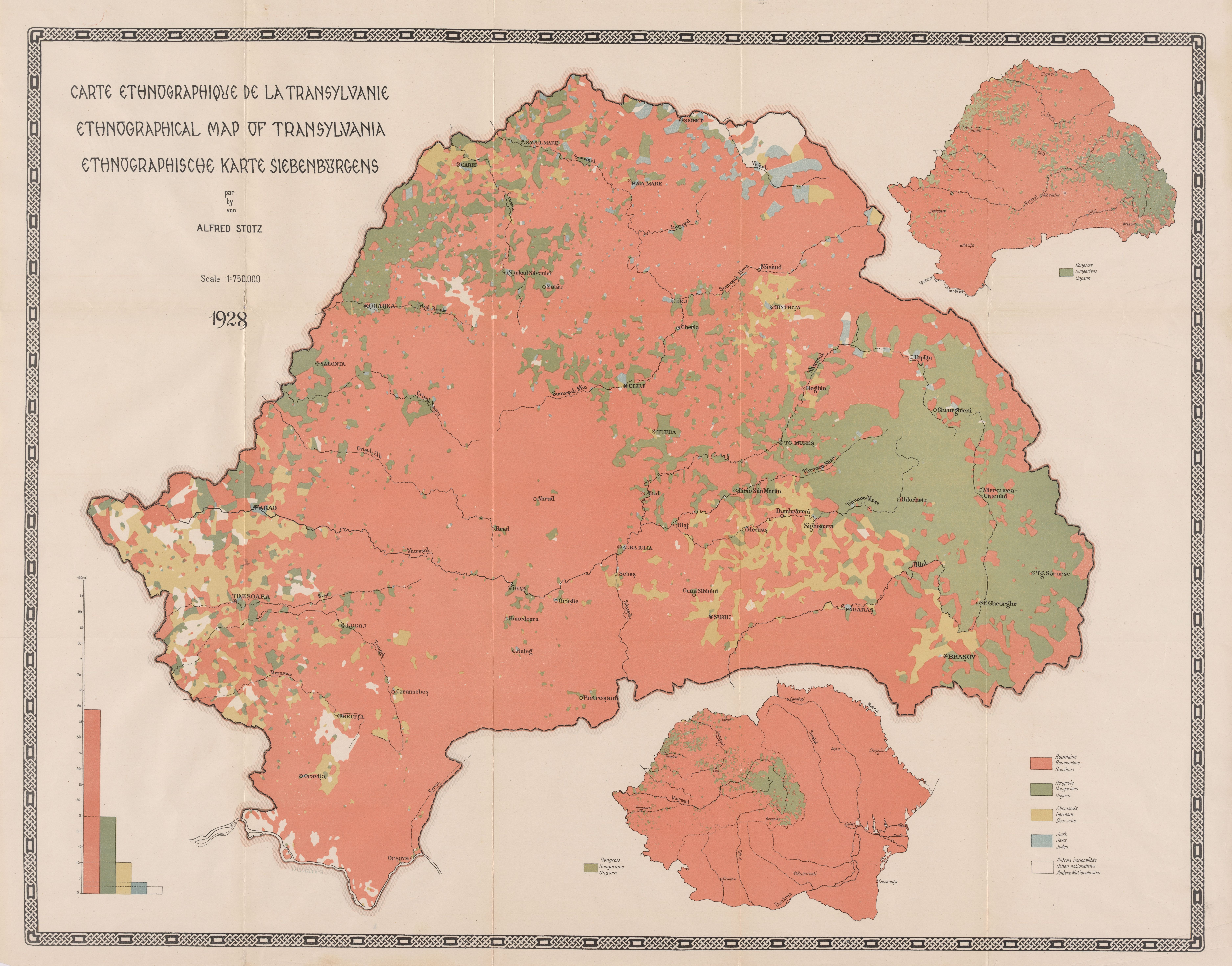
Alfred Stotz: Carte ethnographique de la Transylvanie/ Ethnographical map of Transylvania/ Ethnographische Karte von Siebenbürgen. Berlin, Rumänische Gesandtschaft, 1928. 1:750,000
From the author's private collection
1934
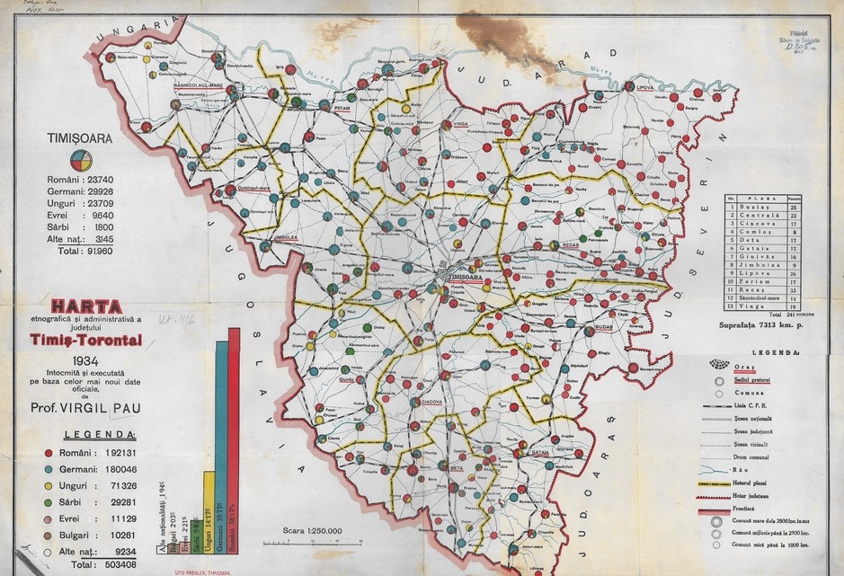
Virgil Pau: Hartă etnografica şi administrativa a judeţului Timiş-Torontal. Timisoara, Megler, 1934. 1:250,000.
Source: MTA CSFK Földrajztudományi Intézet Könyvtár D-705 (Budapest)
1936
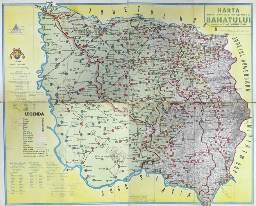
Virgil Pau: Harta fizică, politică şi etnografică a Banatului. Timisoara, D. Loga, 1936. 1:300,000.
Source: Arhivele Nationale Timiș, Fond 104, inventar 210, Collectia harti și planuri, 1/1936 (Timisoara)
1938
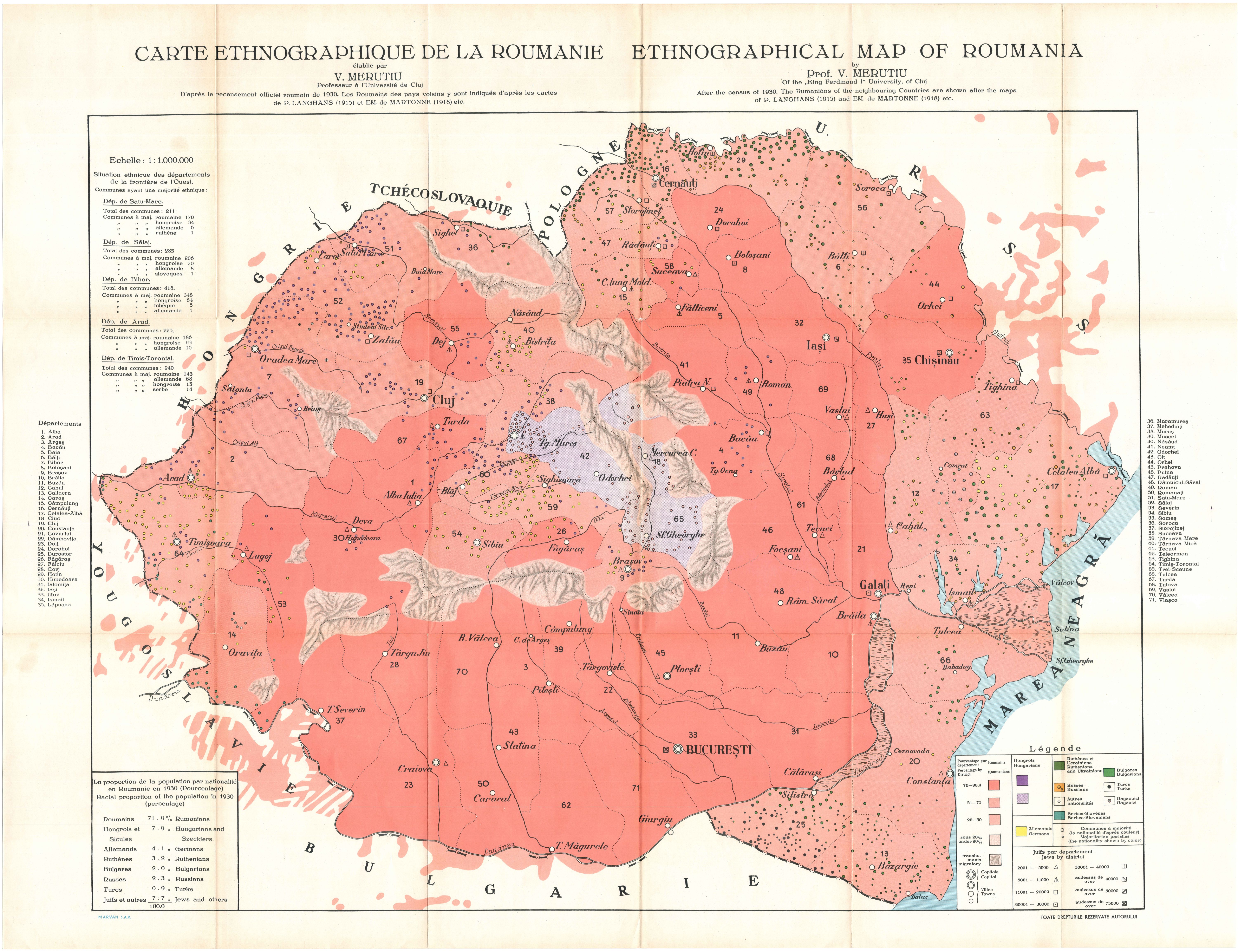
Vasile Meruţiu: Carte ethnographique de la Roumanie. / Ethnographical map of Roumania. In: Vasile Meruţiu: La carte ethnographique de la Roumanie. In: Revue de Transylvanie. 1938. Vol. 4. No. 3–4. pp. 328–334. 1:1,000,000, 100 × 72 cm
From the author's private collection
1939
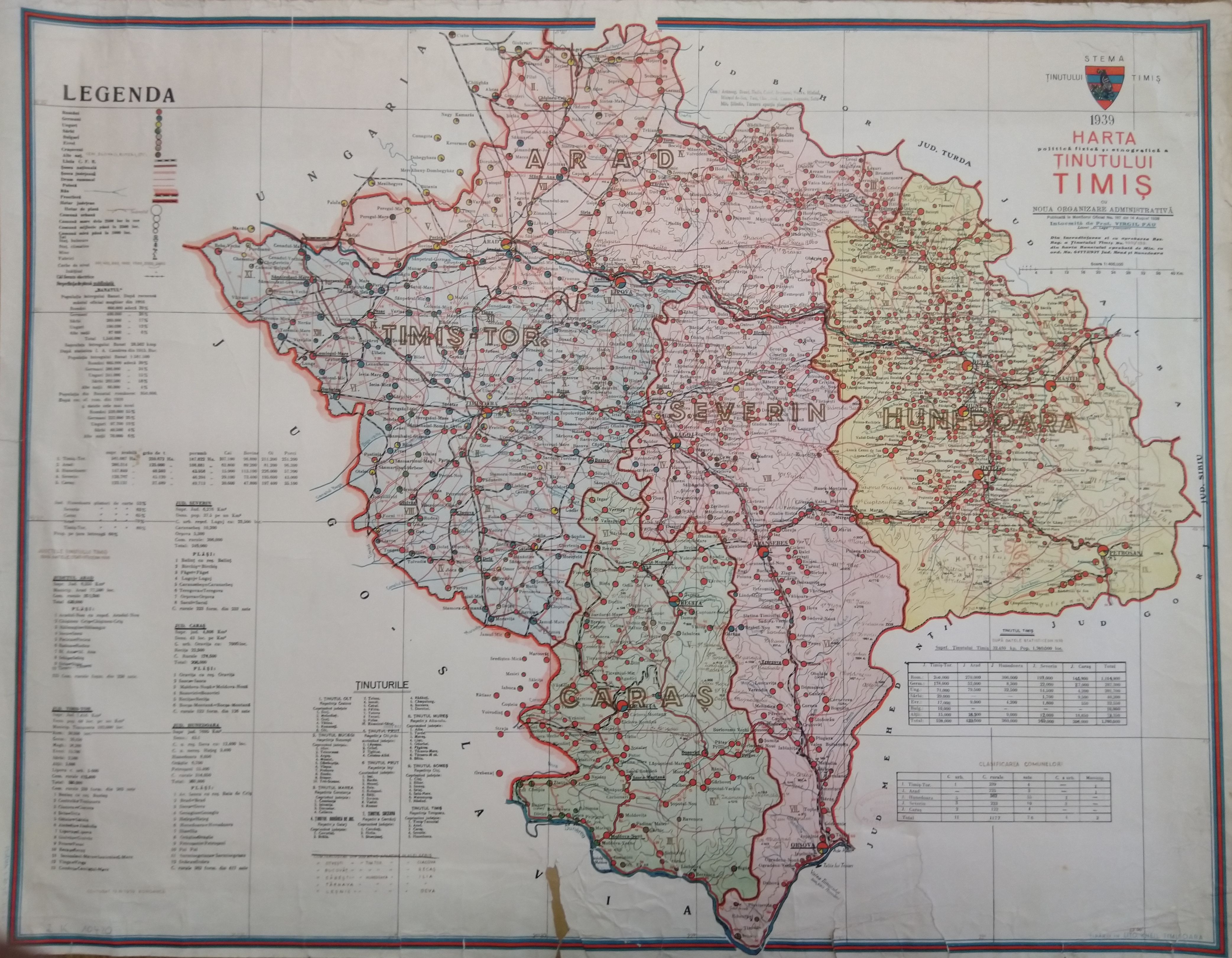
Virgil Pau: Harta politică, fizică şi etnografică a ţinutului Timiş. Timişoara, Kheil, 1939.
193?
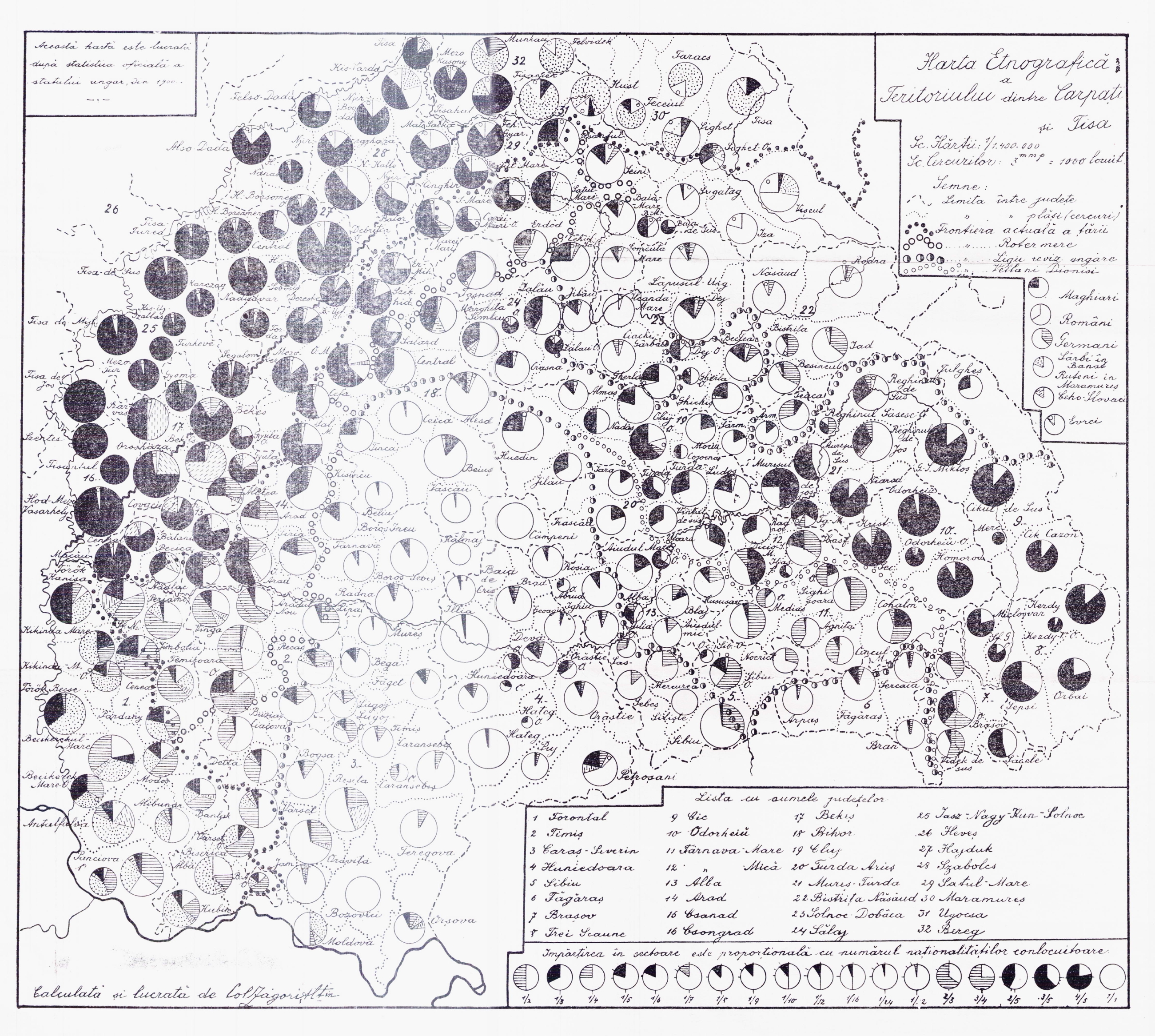
Harta etnografică a teritorului dintre Carpați şi Tisa 193? 1:1,400,000.
Source: Universitatea Babeș-Bolyai, Cholnoky-hagyaték, [49-1452] (Cluj-Napoca)
1940
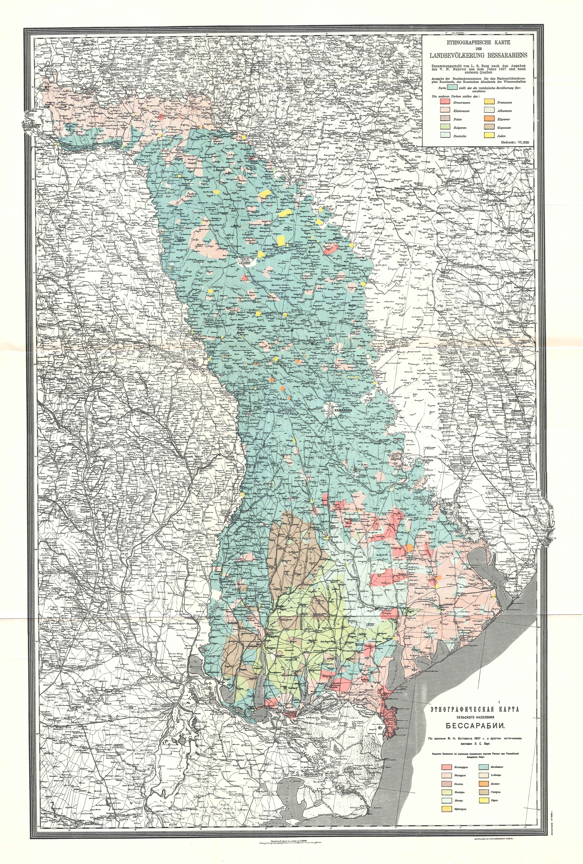
L. S. Berg: Ethnographische Karte der Landbevölkerung Bessarabiens. Original title: Этнографическая карта селъского населенийа Бессарабии. In: Academia Românǎ: Denkschrift betreffend Bessarabien und die Nord-Bukowina. Bucharest, Imprimeria Nationalǎ, 1940. 9. p. m. n.
From the author's private collection
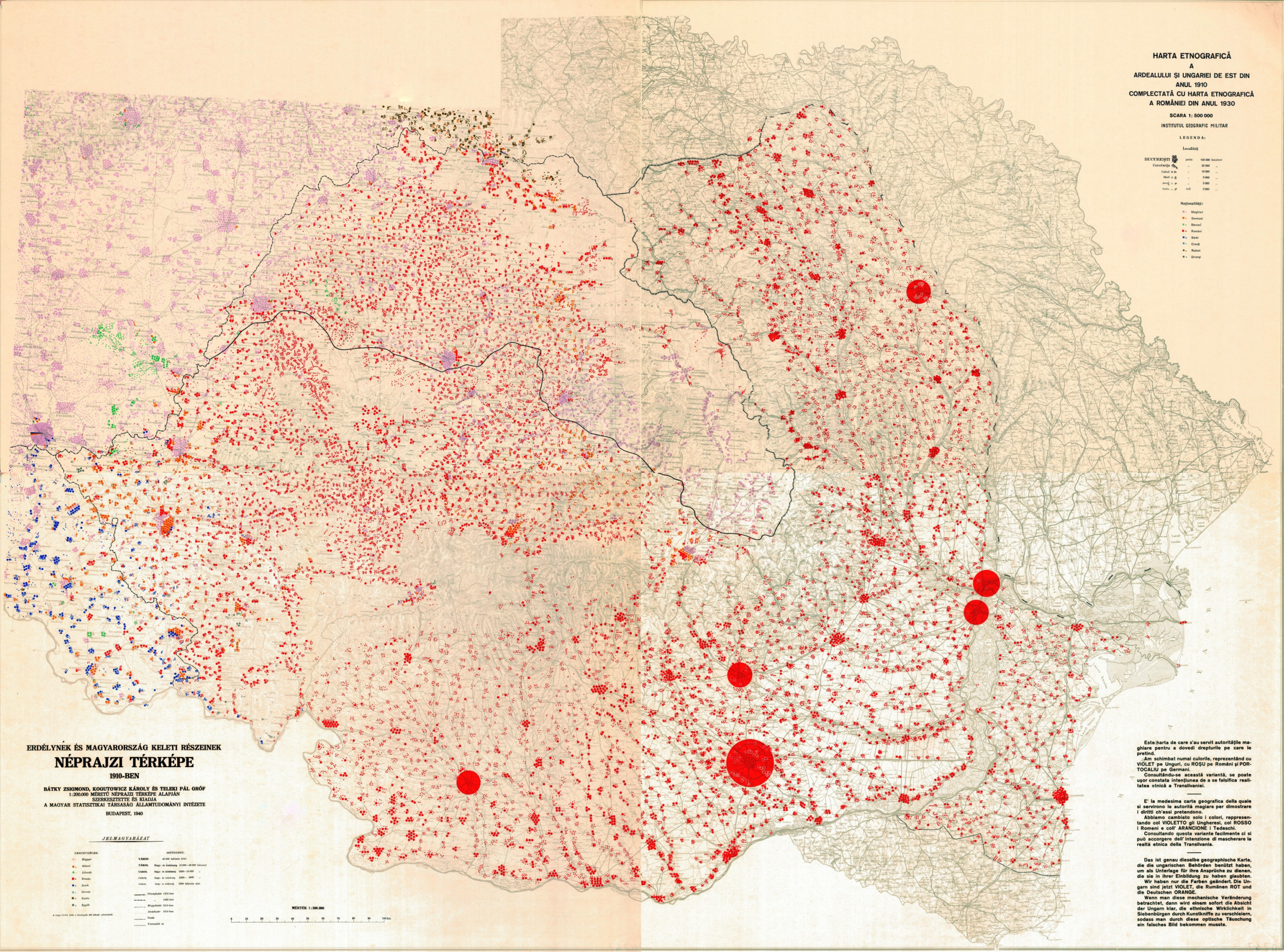
Institutul Geografic Militar: Hartă etnografică a Ardealului şi Ungariei de est din anul 1910, complectată cu hartă etnografică României din anul 1930. Bucharest, 1940 körül. 1:500,000. 4 sheets, 2 versions.
From the author's private collection

Institutul Geografic Militar: Hartă etnografică a Ardealului şi Ungariei de est din anul 1930–1939 complectată cu hartă etnografică a României din anul 1930. Bukarest, 1940. 1:750,000, 2 sheets, 2 versions
Source: Universitatea Babeș-Bolyai, Cholnoky-hagyaték, [54-1250-1;2] (Cluj-Napoca)
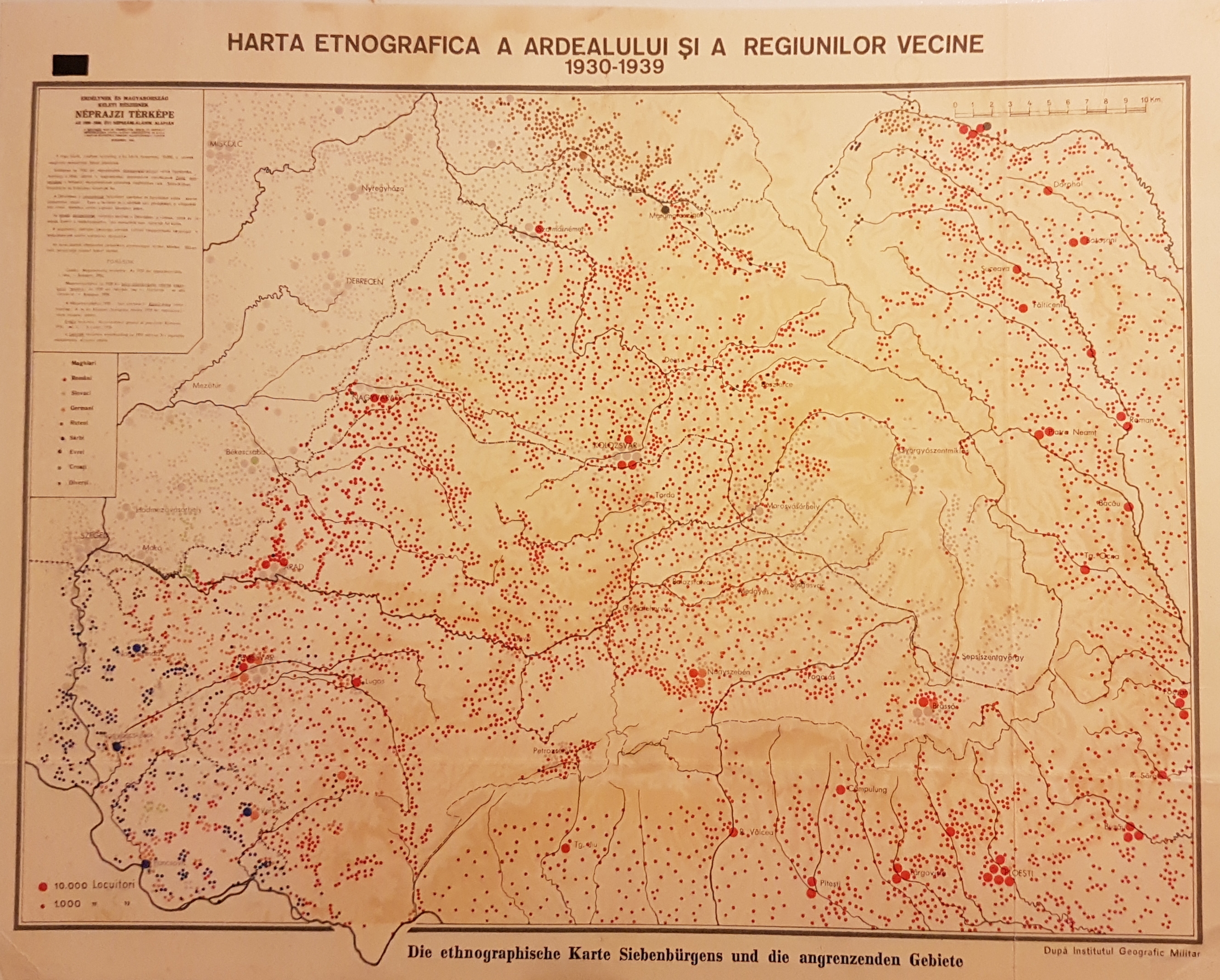
Institutul Geografic Militar: Harta etnografica a Ardealului si a regiunilor vecine. 1930-1939. In: Romania. Atlante Etnografico. Bukarest, Marvan S. A. R., 1940.
From the author's private collection
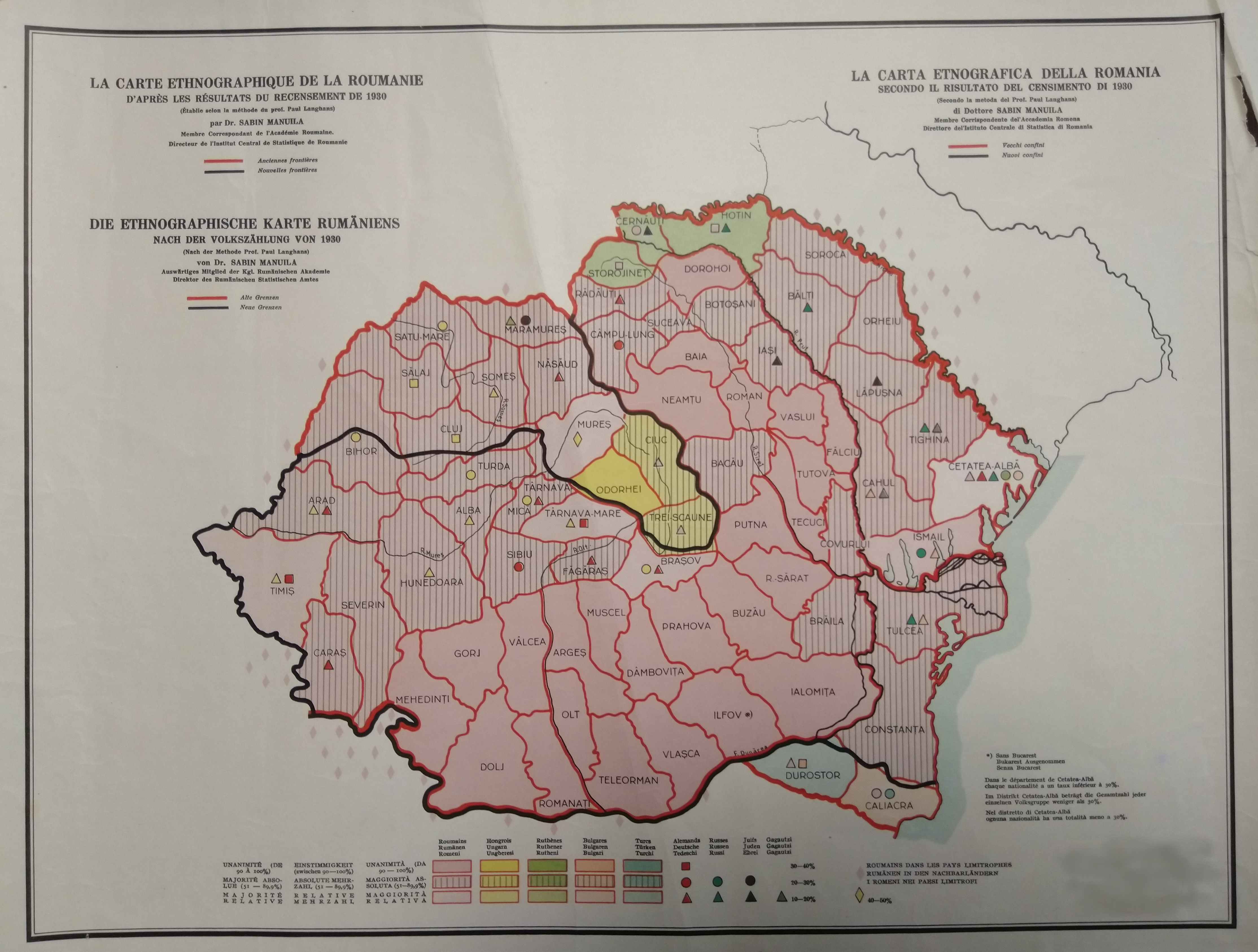
Sabin Manuila: La carte ethnographique de la Roumanie d'après les résultats du recensement de 1930 / Die ethnographische Karte Rumäniens nach der Volkszählung von 1930 / La carta etnografica della Romania secondo il risultato del censimento di 1930. 1940. 1:3 000 000.
Source: private collection
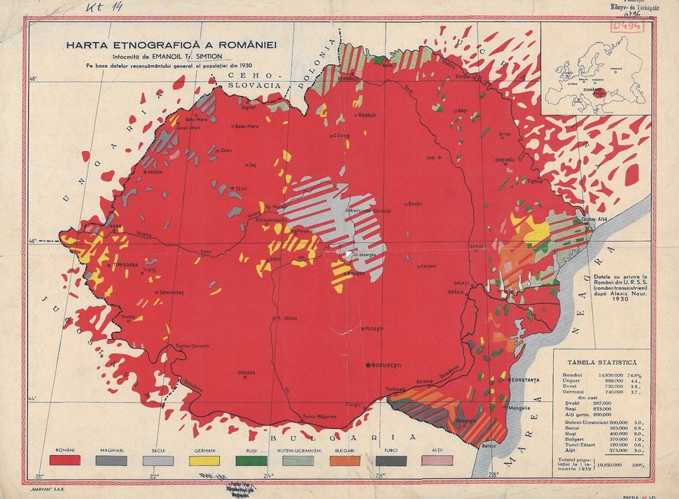
Emanoil Tr. Simtion: Harta etnografică a României. Bukarest, Marvan S. A. R., 1940. 1:2,000,000.
Source: MTA CSFK Földrajztudományi Intézet Könyvtár D-494 (Budapest)
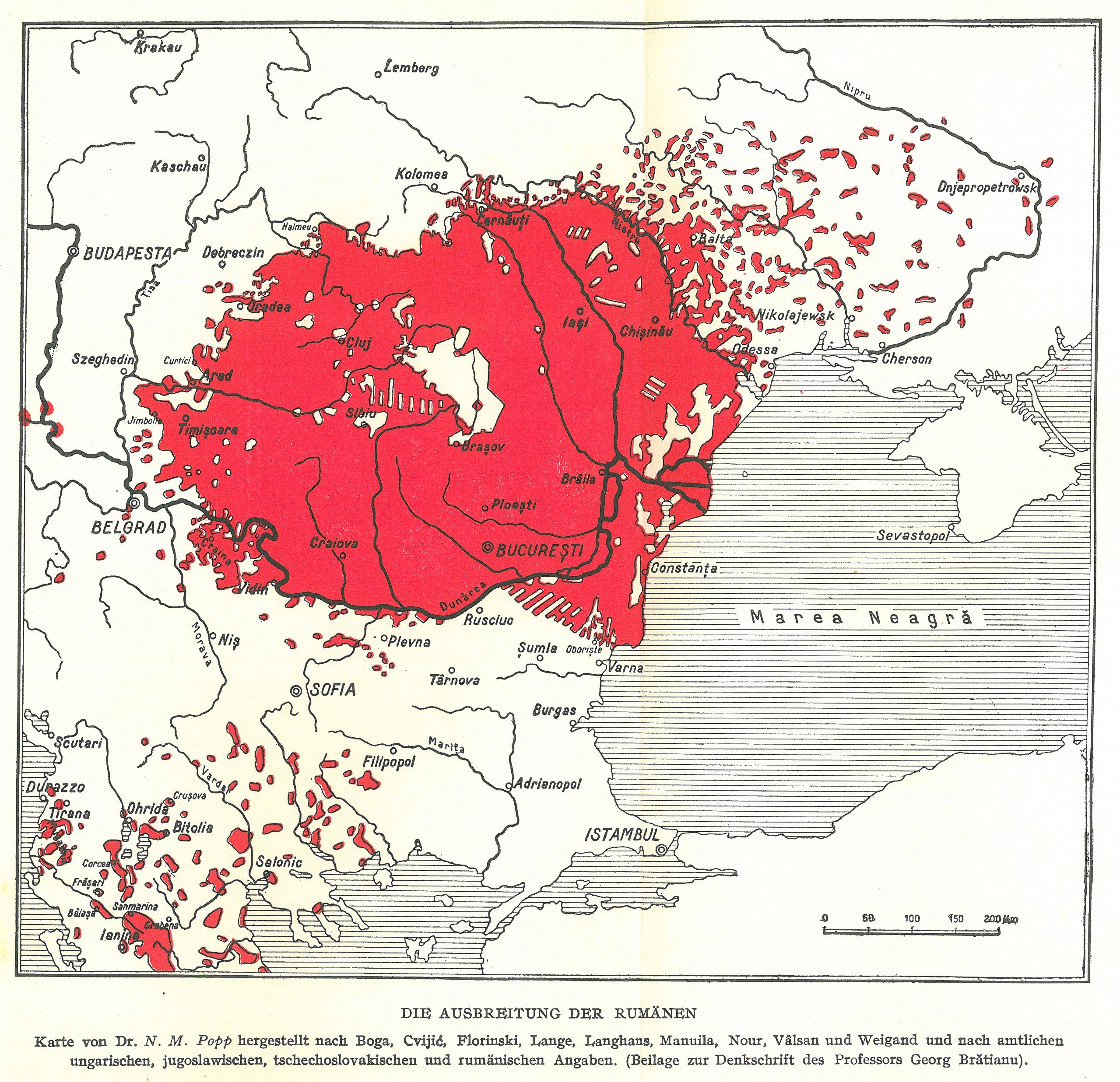
N. M. Popp: Die ausbreitung der Rumänen. In: I. G. Brătianu: Die rumänische Frage. Bucharest, 1940. 1:6,000,000.
From the author's private collection
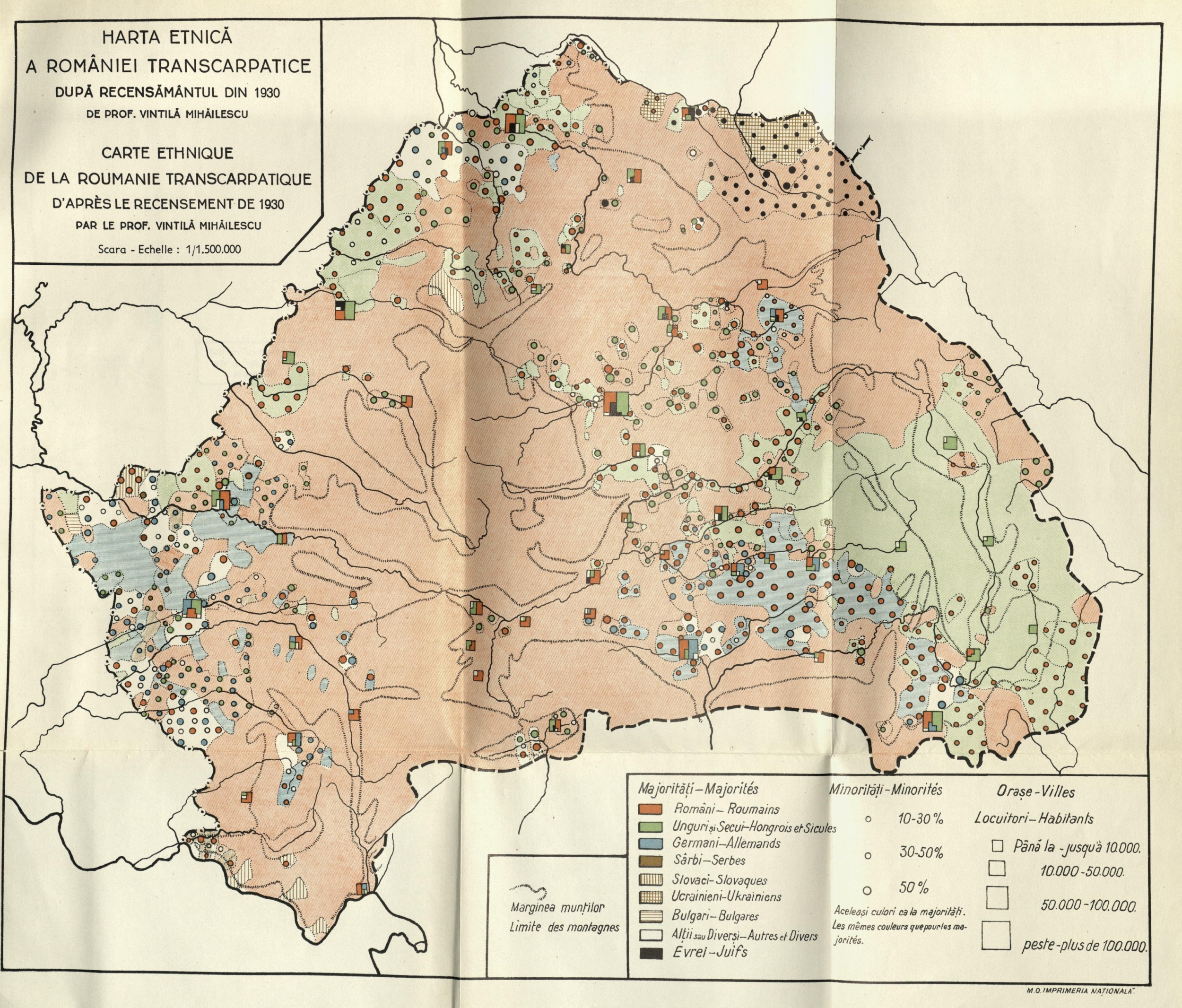
Vintilă Mihăilescu: Harta etnografică a României Transcarpatice. In: Buletinul Societății Regale Române de Geografie. 1940. 1:1,500,000.
From the author's private collection
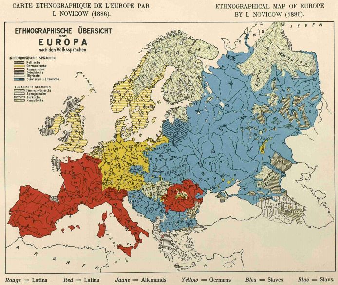
Ethnographical map of Europe (1886). In: La Roumanie. Atlas Ethnographique. Roumania. Ethnographic Atlas. Bucharest, Marvan S. A. R., c. 1940 (The atlas contains 9 various ethnographical maps)
From the author's private collection
1941
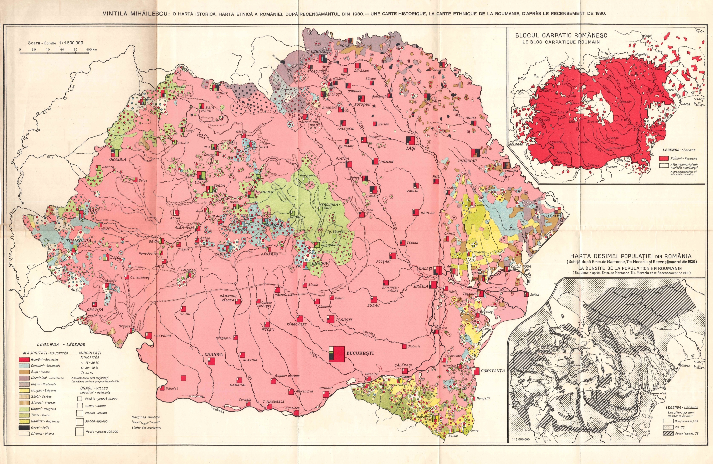
Vintilă Mihăilescu: O Harta istorică, harta etnică a României. In: Vintilă Mihăilescu: Blocul carpatic romanesc. Bucharest, Impimeria Nationala, 1941. 22. p. 1:1,500,000.
From the author's private collection
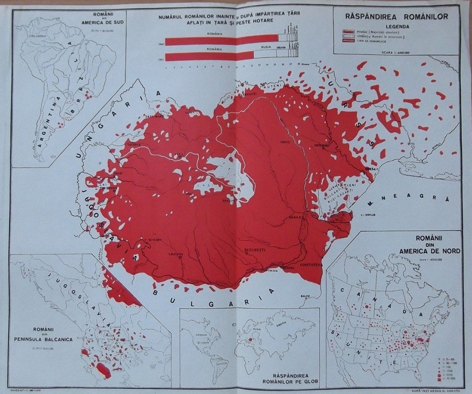
Institutul Geografic Militar: Răspândirea românilor. Bucharest, 1941. 1:2,000,000
Source: private collection
1942
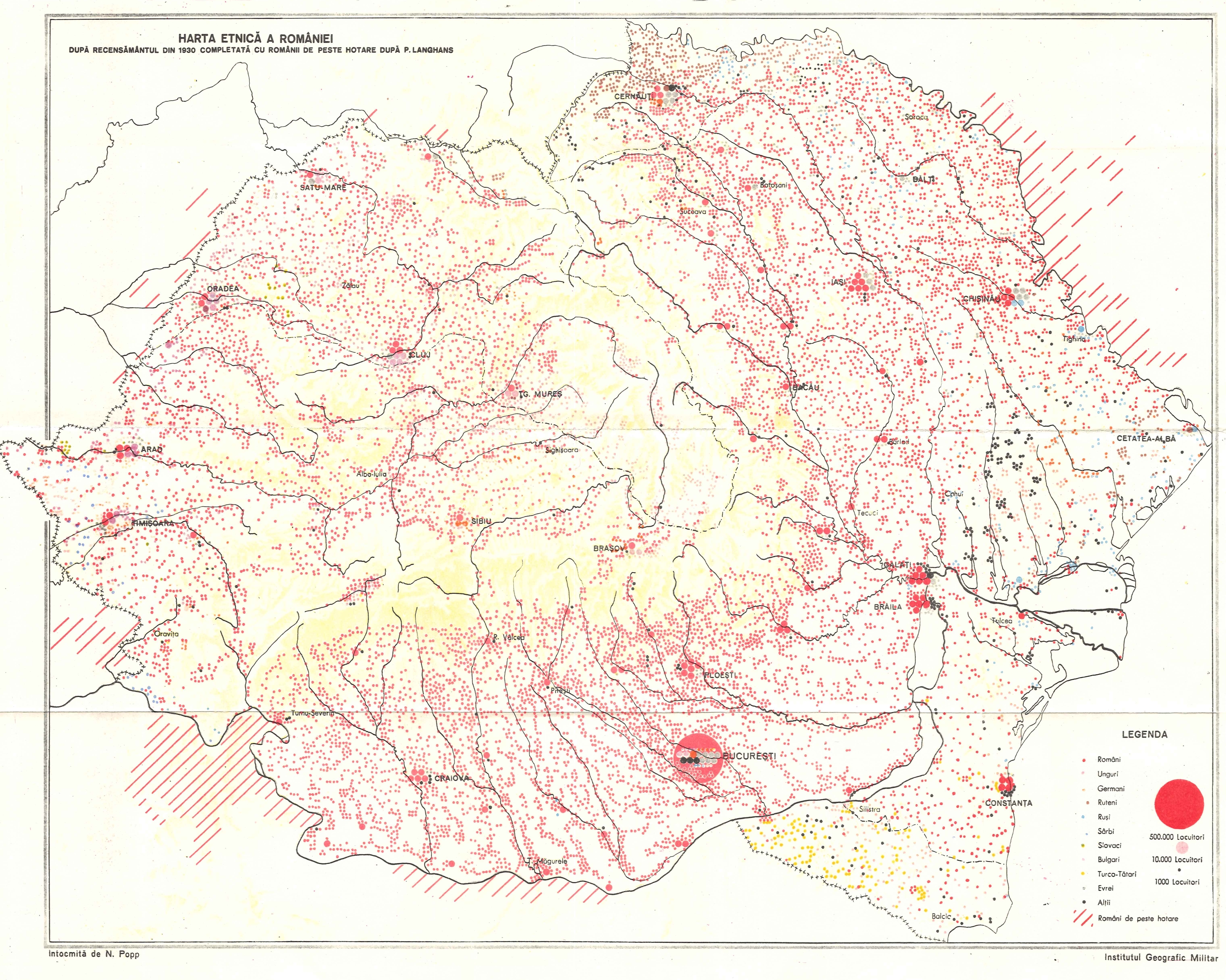
Institutul Geografic Militar: Harta etnica a Romaniei. In: Spaţiul istoric şi etnic românesc. Bucharest, Imprimeria Națională, 1942. 4+28 p. m. n.
From the author's private collection
1943
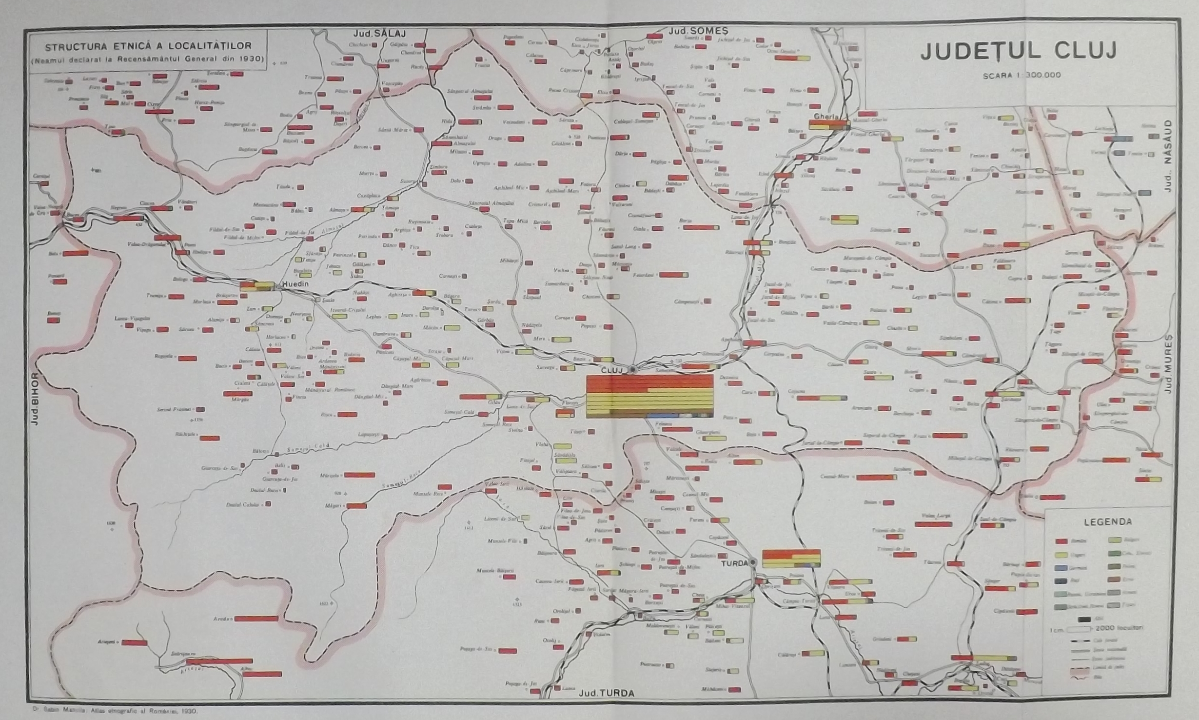
Sabin Manuila: Judetul Cluj. In: Sabin Manuila: Ethnographic Atlas of Rumania, 1930. / Atlas Ethnographique de la Roumanie. 1930. I. Transylvania / La Transylvanie. Bucharest, Central statistical Office of Romania / Institut Central de Statistique de la Roumanie. 1943. 27. p. 1:300,000.
Source: private collection
1945
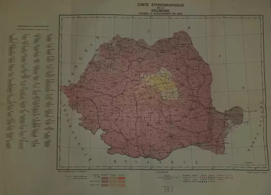
Carte ethnographique de la Roumanie d'aprés le recensement de la 1930.
Bucharest, Institut Géographique de la Armée, 1945. 1 sheet
Source: private collection
1946
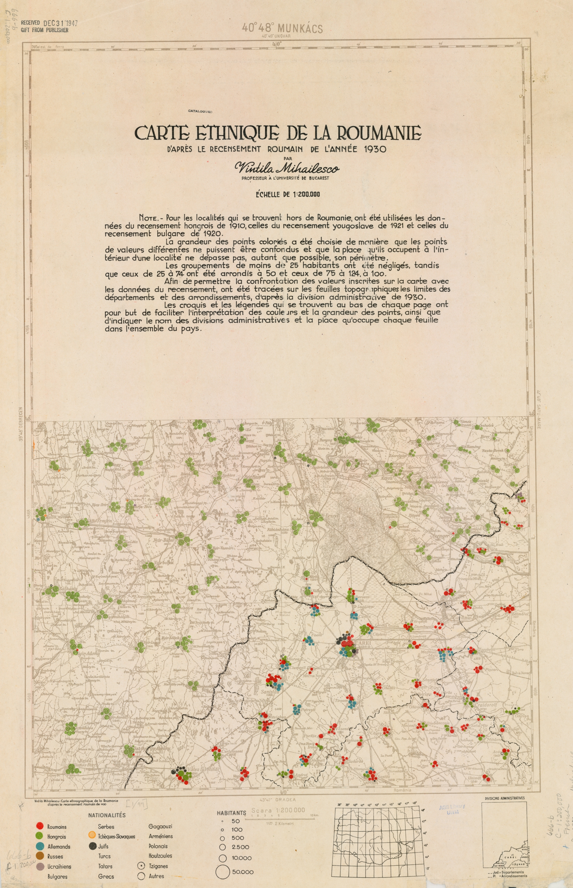
Vintilă Mihăilescu: Carte ethnique de la Roumanie ďaprès le recensement roumain de ľannée 1930. Bucharest, 1946. 33 sheets, 1:200,000.
Source: American Geographical Society Library, University of Wisconsin-Milwaukee Libraries, 666-b C-1:200,000 French (Milwaukee)
19??

27. România. Harta etnică. 19??
From the author's private collection
Dániel Zoltán Segyevy
Many thanks to Zsofia Lovei, for her lingual revision of this text.


